+91 9910402252
admin@chalbanjare.com
| Entry Fee | Free |
| Timings | 06:00 - 18:00 |
| Altitude (m) | 4611 |
| Ideal Visit Duration (hrs) | 0.25 |
| Best Time of Day | Morning |
| Crowd Level | Low |
| Distance from Leh (km) | 165 |
| Walking Difficulty | Easy |
| Parking Available | Yes |
| Last Mile Access | Road |
| Suitable for Kids | Yes |
| Suitable for Seniors | Yes |
| Wheelchair Friendly | No |
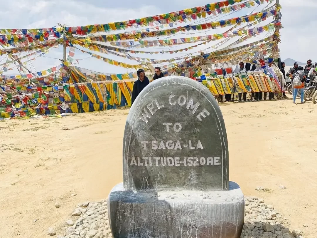
Tsaga La is a remote high-altitude pass situated at approximately 15,200 feet, serving as a critical transit point for travelers moving between the nomadic hub of Hanle and the border village of Chushul. It is visited by explorers who wish to traverse the "Inner Line" frontier, offering a raw and unpaved journey through the sensitive eastern edge of the Changthang plateau near the Line of Actual Control.
The atmosphere at Tsaga La is defined by an immense sense of space and the physical presence of the Indo-China border. The landscape is characterized by wide, sandy valleys and rolling brown hills that stretch toward the horizon, where the only signs of activity are the occasional Indian Army convoys and the solitary tents of the Rebo nomads tending to their herds of pashmina goats in the vast, windswept plains.
What makes Tsaga La distinct is its proximity to the historic Tsaga village and its role as a corridor for observing rare high-altitude wildlife in their natural habitat. It offers one of the best opportunities in Ladakh to spot the Kiang (Tibetan wild ass) and the elusive Black-necked Crane, providing a unique vantage point where the stark beauty of the trans-Himalayan desert meets the quiet resilience of borderland life.
Tsaga La is a high-altitude mountain pass located at an elevation of approximately 4,650 meters (15,256 feet) in the Changthang region of Ladakh. It serves as a vital connecting point between the villages of Chushul and Loma, facilitating transit along the remote eastern border of India.
Geographically, the pass is situated in a high-plateau desert landscape characterized by vast open plains and salt-encrusted basins. It is a critical landmark on the road leading toward the Rezang La War Memorial and the strategic Nyoma sector. The region surrounding the pass is an essential habitat for the Kiang (Tibetan wild ass) and other rare Trans-Himalayan wildlife that thrive in the sparse vegetation of the high-altitude steppe.
Historically, Tsaga La has been a traditional route for the nomadic Changpa people, who move their herds of pashmina goats through these corridors to reach seasonal grazing lands. Due to its close proximity to the Line of Actual Control (LAC), the pass is of significant strategic importance and is strictly monitored by the Indian Army. It remains a sensitive zone where specific Inner Line Permits (ILP) are mandatory for all civilian travelers.
Tsaga La, situated at approximately 15,207 feet, is a remote and strategically sensitive pass on the high-altitude corridor between Chushul and Hanle. Unlike the major highways of Ladakh, this route consists largely of raw dirt tracks and gravel, making its accessibility dependent on dry ground conditions and the stability of the border region's seasonal weather.
Tsaga La is a remote, high-altitude mountain pass located in the Changthang region of Ladakh at an elevation of approximately 4,640m (15,223 ft). It is a strategic transit point that connects the Chushul Valley to the Loma-Hanle sector, offering travelers a direct route through the stark, high-altitude desert along the Indus River.
Tsaga La, standing at an elevation of approximately 4,650 meters (15,255 feet), is a strategic mountain pass connecting the Rezang La memorial area with the Indus Valley. Photography here is defined by wide-open vistas of the Changthang Plateau and the stark, dramatic proximity to the mountains marking the Line of Actual Control (LAC).
 Mountain Pass
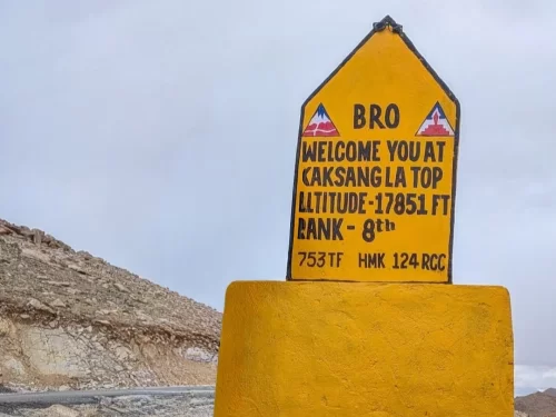
Kaksang La is a high-altitude mountain pass situated at an elevation of approximately 5,438 meters (17,841 feet) in the Leh district of Ladakh.
 Mountain
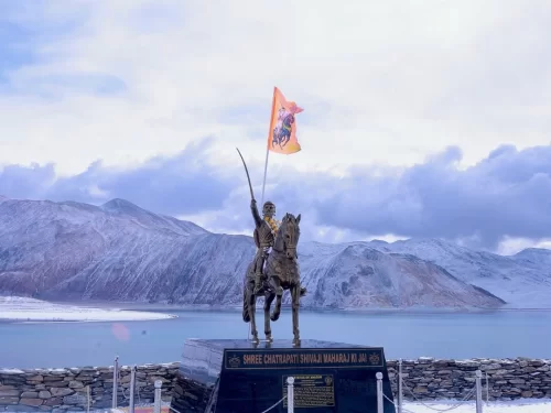
Pangong Tso is the world's highest saltwater lake, famous for its mesmerizing ability to change colors from turquoise to deep blue.
 Mountain Pass
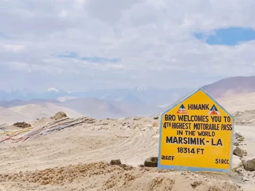
Marsimik La is a high-altitude mountain pass situated at an elevation of approximately 5,582 meters (18,314 feet) in the eastern Ladakh region, near the northern shore of Pangong Tso.
Get customized Ladakh tour planning designed around altitude comfort, acclimatization time, weather windows, and real Himalayan road conditions. Whether you are visiting for high mountain passes, monasteries, lakes, or remote valley experiences, our exper
⚡ Quick Response | 💰 Free consultation | 🕒 24×7 expert support

