Quick Facts About Singe La
| Entry Fee | Free |
| Timings | 06:00 - 18:00 |
| Altitude (m) | 5090 |
| Ideal Visit Duration (hrs) | 1 |
| Best Time of Day | Morning |
| Crowd Level | Low |
| Distance from Leh (km) | 125 |
| Walking Difficulty | Easy |
| Parking Available | No |
| Last Mile Access | Road |
| Suitable for Kids | No |
| Suitable for Seniors | No |
| Wheelchair Friendly | No |
Why Visit Singe La Pass
Singe La Pass is visited by travelers who want to experience a real high altitude crossing on the Lamayuru to Lingshed route rather than a curated viewpoint. It appeals to those interested in remote Himalayan roads, dramatic terrain changes, and understanding how isolated Zanskar settlements are connected. The visit is about movement and transition, not sightseeing amenities.
Atmosphere
The atmosphere at Singe La Pass is raw and exposed. Strong winds are common, oxygen levels are low, and the surroundings are largely barren with no permanent human presence. Traffic is sparse, and long stretches of silence dominate the pass, creating a strong sense of isolation and scale.
What Makes It Special
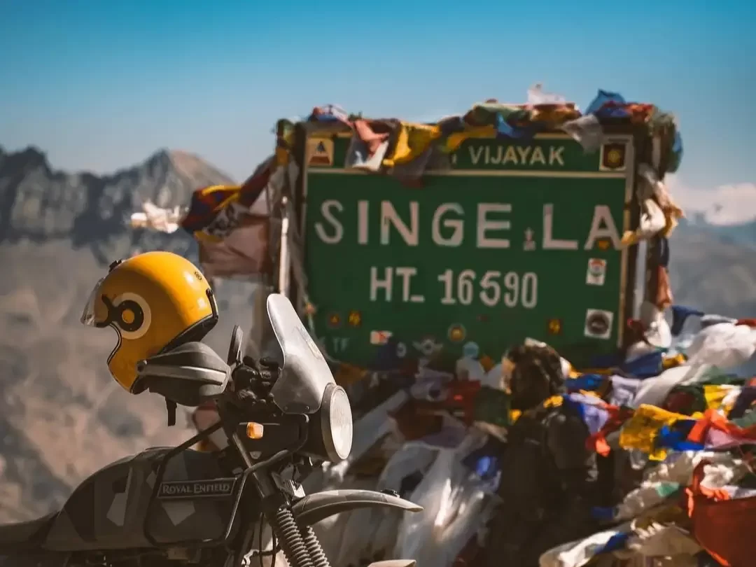
Singe La is special because it marks the highest and most demanding section of the road linking Lamayuru with Lingshed. Unlike popular tourist passes, it has no commercial activity, signage, or developed viewpoints. Crossing it highlights the engineering challenges of Zanskar roads and offers a clear geographical transition from the Indus Valley side toward the interior Zanskar landscape.
Route Background of Singe La Pass
Singe La Pass does not have a recorded historical monument, religious structure, or cultural site located at the pass itself. Its importance comes from its long standing role as a natural mountain crossing between Lamayuru and the remote settlement of Lingshed in Zanskar.
For centuries, this route was used by villagers, monks, and traders traveling on foot or with pack animals to move between the Indus Valley side and interior Zanskar. The modern motorable road follows the same natural alignment shaped by terrain rather than design. Singe La remains a functional passage defined by geography, altitude, and climate, preserving its role as a practical connector rather than a destination of heritage or ritual significance.
Best Time to Visit Singe La Pass
Singe La Pass is best crossed during a short summer window when the Lamayuru to Lingshed road is open and weather conditions are manageable. Because of its high altitude and exposed setting, timing directly affects safety, visibility, and overall comfort.
- Late June to September is the most reliable period, when snow has cleared and the road is generally passable
- July and August offer the most stable conditions, though strong winds and sudden cloud cover are common
- Early September is suitable for travelers seeking fewer vehicles and clearer skies, with colder mornings
- October to May is not recommended due to snowfall, sub zero temperatures, and road closures
- Late morning to early afternoon is the safest time of day to cross, with better visibility and slightly warmer conditions
How to Reach Singe La Pass
- Singe La Pass is now connected by a motorable road linking Lamayuru with Lingshed in the Zanskar region
- The road approach starts from Lamayuru, which lies on the Leh Srinagar highway and is easily reachable from Leh by taxi or private vehicle
- From Lamayuru, a rough mountain road climbs toward Singe La and continues onward to Lingshed village
- High ground clearance vehicles are recommended due to uneven surfaces, loose gravel, and steep sections
- There is no regular public transport on this route; private taxis or self driven vehicles are the only practical options
- Road conditions vary by season and weather, and landslides or washouts are possible after rain
- No permits are required specifically for Singe La, but route conditions should be confirmed locally before travel
What to Expect When You Visit Singe La Pass
- Expect a high altitude mountain crossing rather than a developed tourist spot, with no facilities or marked viewpoints
- The road surface is rough and uneven, with loose gravel and steep gradients on both sides of the pass
- Weather conditions can change quickly, with strong winds and sudden drops in temperature even during summer
- There are no shops, restrooms, fuel stations, or shelters anywhere near the pass
- Mobile network connectivity is absent across most of the route
- Travelers usually stop only briefly due to wind exposure and altitude
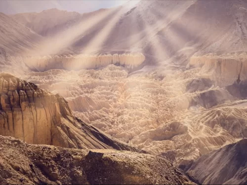
- The surroundings are barren and remote, offering a raw view of Zanskar terrain rather than scenic photo stops
- Altitude related discomfort is possible if acclimatization is inadequate
Important Visitor Information for Singe La Pass
- Crowd and weather notes: Singe La Pass sees very low traffic, limited to local vehicles and occasional travelers. Weather is highly unpredictable, with strong winds, sudden cloud cover, and sharp temperature drops even in summer
- Peak hours: Late morning to early afternoon, when visibility is better and temperatures are relatively stable
- Quiet hours: Early morning and late evening are extremely quiet but not ideal due to cold, low visibility, and higher weather risk
- Dress code: Warm layered clothing is essential, including windproof jackets, gloves, and head protection due to constant exposure
- Safety notes: Avoid stopping for long periods at the pass due to altitude and wind chill. Drive cautiously on loose gravel and steep sections, and ensure proper acclimatization before crossing
- Check local road and weather conditions before travel, as landslides or washouts can occur without notice
Photography and Viewpoint at Singe La Pass
- Singe La Pass does not have a designated viewpoint or viewing platform; photography is done from safe roadside spots
- The landscape is open and barren, offering wide angle views of surrounding ridgelines and the transition between Lamayuru and Lingshed regions
- Late morning provides the best light, with clearer visibility and reduced shadow contrast
- Strong winds are common and can affect camera stability and image sharpness
- There are no foreground structures or landmarks, so compositions rely on scale, road curves, and mountain layers
- Stopping for photography should be brief due to altitude, wind exposure, and lack of shelter
- Drone photography is not recommended due to wind conditions and local restrictions
- Photographers should prioritize personal safety and vehicle positioning over capturing shots