+91 9910402252
admin@chalbanjare.com

| Entry Fee | Free |
| Timings | 00:00 - 23:59 |
| Altitude (m) | 3510 |
| Ideal Visit Duration (hrs) | 0.5 |
| Best Time of Day | Morning |
| Crowd Level | Moderate |
| Distance from Leh (km) | 115 |
| Walking Difficulty | Easy |
| Parking Available | Yes |
| Last Mile Access | Road |
| Suitable for Kids | Yes |
| Suitable for Seniors | Yes |
| Wheelchair Friendly | No |
Visitors stop at Moonland to see its unusual eroded hills that resemble a lunar surface. Located along the Leh–Kargil highway near Lamayuru village, it is a natural roadside viewpoint where travelers pause to observe and photograph the distinct pale-yellow and grey sediment formations.
The atmosphere is quiet and open, typical of Ladakh’s high-altitude desert landscape. With minimal commercial activity and no built infrastructure at the site itself, the experience is brief and centered on observing the terrain against the stark mountain backdrop and wide skies.
What makes Moonland distinct is its geological appearance, formed by centuries of wind and water erosion acting on soft rock layers. Unlike green valleys or snow-covered peaks common in Ladakh, this site stands out for its textured, crater-like slopes and unusual coloration visible directly from the highway.
Moonland is not a man-made or historically constructed site but a natural geological formation created over long periods through erosion of soft sedimentary rock. The layered hills visible today were shaped by wind and water activity in Ladakh’s cold desert climate, resulting in the distinctive cratered appearance.
The name “Moonland” is a modern descriptive term used by travelers due to the terrain’s resemblance to the lunar surface. The area lies close to Lamayuru village and the historic Lamayuru Monastery, but the landscape itself does not hold documented historical or religious structures within its formation.
Moonland is best visited during Ladakh’s open travel season when road access via the Leh–Kargil Highway is reliable and weather conditions are stable. As it is a roadside geological viewpoint at high altitude, accessibility depends largely on regional road and climate conditions.
 Monastery
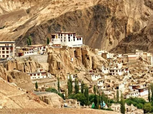
Lamayuru Monastery, also known as Tharpa Ling, is one of the oldest and largest Tibetan Buddhist monasteries in Ladakh, situated at an elevation of approximately 3,510 meters (11,516 feet) on the Srinagar-Leh Highway.
 Mountain Pass
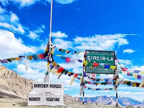
Sirsir La is a remote high altitude mountain pass in Ladakh that connects Lamayuru with the isolated village of Photoksar.
 Mountain Pass
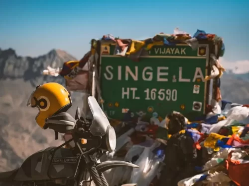
Singe La is a high altitude mountain pass in Zanskar that connects Lamayuru with the remote village of Lingshed.
Get customized Ladakh tour planning designed around altitude comfort, acclimatization time, weather windows, and real Himalayan road conditions. Whether you are visiting for high mountain passes, monasteries, lakes, or remote valley experiences, our exper
⚡ Quick Response | 💰 Free consultation | 🕒 24×7 expert support

