+91 9910402252
admin@chalbanjare.com
| Entry Fee | Free |
| Timings | 09:00 - 18:00 |
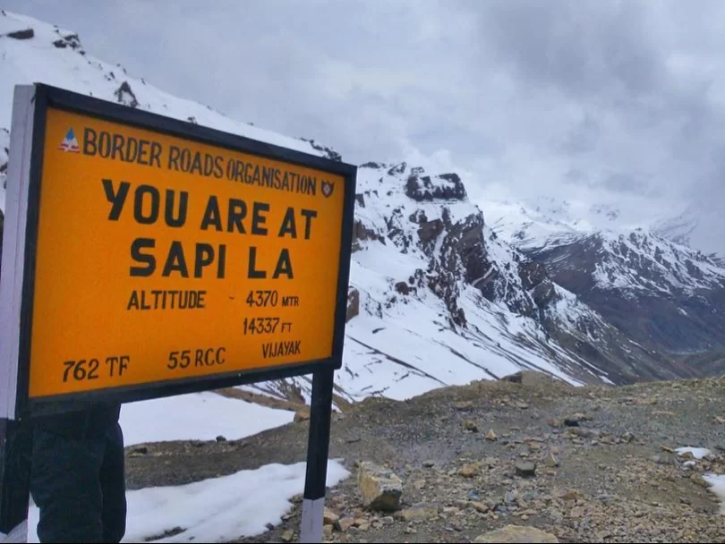
| Altitude (m) | 4397 |
| Ideal Visit Duration (hrs) | 1 |
| Best Time of Day | Morning |
| Crowd Level | Moderate |
| Distance from Kargil (km) | 75 |
| Walking Difficulty | Easy |
| Parking Available | Yes |
| Last Mile Access | Road |
| Suitable for Kids | Yes |
| Suitable for Seniors | Yes |
| Wheelchair Friendly | No |
Sapi La is visited mainly by travelers exploring lesser-known routes in the Kargil region who want to experience a high-altitude mountain pass without crowds or commercial development. It works best as a natural stop on a longer road journey rather than a destination planned on its own.
The atmosphere at Sapi La is quiet and open, shaped by wide mountain views and minimal human presence. Being a motorable pass, it feels transitional rather than isolated, with changing weather, strong winds, and vast empty terrain defining the experience instead of built attractions.
What makes Sapi La special is its raw geography and simplicity. There are no signboards, shops, or tourist facilities, allowing travelers to observe Ladakh’s landscape in an unfiltered form. It offers a clear sense of altitude and terrain while remaining easily accessible by road, making it meaningful for those interested in authentic travel rather than checklist sightseeing.
Sapi La has historically served as a high-altitude mountain pass facilitating movement between nearby valleys in the Kargil region. Its primary importance is geographic, providing a natural route for local travel and transport rather than being associated with historical events, religious sites, or settlements.
The pass continues to function as a motorable connector, allowing travelers to navigate the rugged terrain of Ladakh efficiently. Its significance lies in the continuity of practical usage over time, linking communities and valleys through an accessible high-altitude route.
Unlike other Himalayan passes with trade, religious, or ceremonial relevance, Sapi La’s relevance is purely functional, highlighting the role of topography in shaping movement and access within the region.
The ideal time to visit Sapi La is during the summer months when the motorable road is open and weather conditions are stable. Snow can block access during winter, making the pass unsafe and unsuitable for casual travelers.
From May to September, travelers can drive through the pass safely, enjoy clear views of the surrounding mountains, and experience the high-altitude environment without extreme cold or heavy snow.
 Monastery
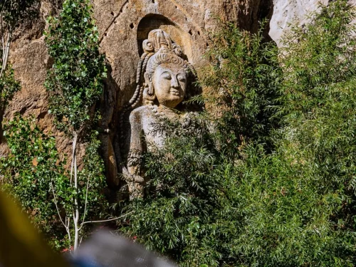
Mulbekh Monastery is a dual Tibetan Buddhist monastery consisting of two gompas (Serdung and Rgaldan-se) overlooking the Srinagar-Leh Highway at an elevation of approximately 3,304 meters (10,840 feet).
 Mountain Pass
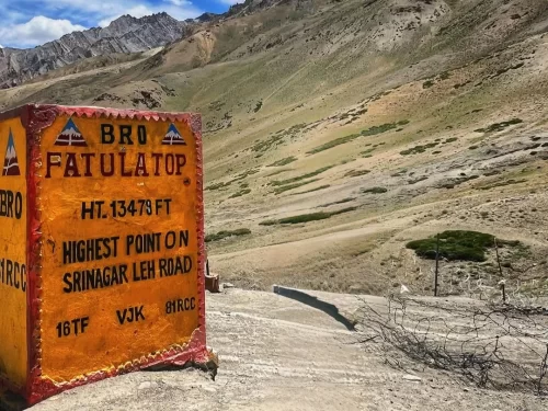
Fotu La is a high-altitude mountain pass situated at an elevation of approximately 4,108 meters (13,478 feet) in the Zanskar Range of the Himalayas.
 Mountain Pass
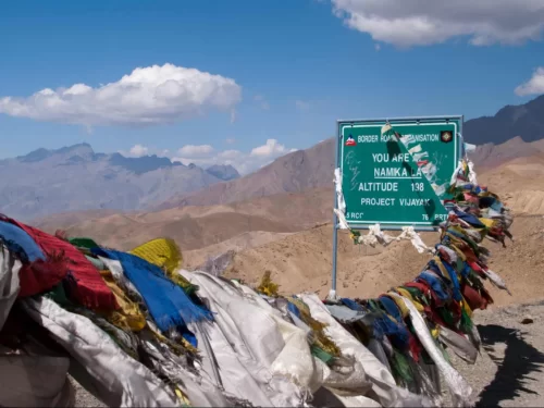
Namika La, also known as the Pillar of the Sky, is a high-altitude mountain pass situated at an elevation of approximately 3,700 meters (12,139 feet) in the Zanskar Range.
Get customized Ladakh tour planning designed around altitude comfort, acclimatization time, weather windows, and real Himalayan road conditions. Whether you are visiting for high mountain passes, monasteries, lakes, or remote valley experiences, our exper
⚡ Quick Response | 💰 Free consultation | 🕒 24×7 expert support

