+91 9910402252
admin@chalbanjare.com
| Entry Fee | Free |
| Timings | 06:00 - 18:00 |
| Altitude (m) | 5400 |
| Ideal Visit Duration (hrs) | 1 |
| Best Time of Day | Morning |
| Crowd Level | Low |
| Distance from Leh (km) | 150 |
| Walking Difficulty | Hard |
| Parking Available | No |
| Last Mile Access | Road |
| Suitable for Kids | No |
| Suitable for Seniors | No |
| Wheelchair Friendly | No |
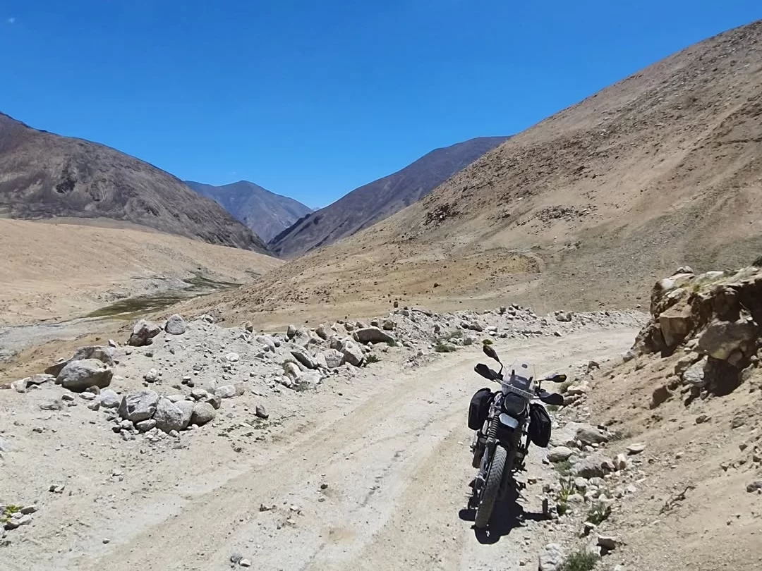
Kela Pass is visited only by travelers seeking an understanding of Ladakh’s extreme geography and strategic road networks. It is not a sightseeing destination and does not function as a practical route for most Pangong Lake visitors. The interest lies in its remoteness, elevation, and the reality of restricted high altitude corridors rather than ease of travel.
The atmosphere is austere and tightly controlled. There are no settlements, no tourist movement, and no commercial activity. Weather conditions can change rapidly, and the presence of the Indian Army defines movement and access. The environment feels isolated, exposed, and operational rather than scenic.
What makes Kela Pass distinct is its status as a largely inaccessible and non tourist mountain route. At over five thousand meters, it represents the extreme end of civilian road access in Ladakh. Its significance comes from geography and strategic relevance, offering perspective on why most travelers rely on established Pangong routes instead of alternative passes like this one.
Kela Pass has historically functioned as a strategic and operational mountain corridor rather than a civilian travel route. Its alignment lies in a sensitive eastern Ladakh zone where movement has long been influenced by border security considerations rather than trade or settlement patterns.
Unlike traditional passes that evolved around villages, seasonal migration, or commercial exchange, Kela Pass remained largely inaccessible to civilian use. Road development in this area was undertaken primarily for military logistics and patrol movement, which explains the absence of historical settlements, rest points, or cultural landmarks along the route.
In recent times, the pass is occasionally referenced as an alternative approach toward Pangong Lake, but this remains conditional and restricted. Its relevance today is tied to modern strategic infrastructure rather than historical travel or cultural significance, reflecting how geography and security continue to shape access in eastern Ladakh.
The best time to attempt travel toward Kela Pass is during the short summer window when high altitude routes in eastern Ladakh are snow free and weather conditions are comparatively stable. Even during this period, access depends on security clearance and real time road status rather than seasonal preference.
Late morning to early afternoon is the safest time frame if access is granted, as temperatures are slightly higher and visibility is better. Travelers should treat this route as conditional and avoid planning it as a guaranteed alternative to standard Pangong Lake roads.
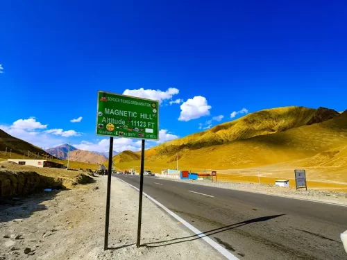 Tourist Attraction
Magnetic Hill is a gravity hill located at an elevation of approximately 3,350 meters (10,991 feet) on the Leh-Srinagar National Highway.
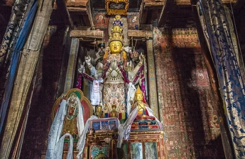 Monastery
Alchi Monastery is a historic Buddhist temple complex situated at an elevation of approximately 3,100 meters (10,170 feet) on the southern bank of the Indus River.
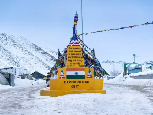 Mountain Pass
Chang La is a high-altitude mountain pass situated at an elevation of approximately 5,360 meters (17,585 feet) on the road between Leh and Pangong Tso.
Get customized Ladakh tour planning designed around altitude comfort, acclimatization time, weather windows, and real Himalayan road conditions. Whether you are visiting for high mountain passes, monasteries, lakes, or remote valley experiences, our exper
⚡ Quick Response | 💰 Free consultation | 🕒 24×7 expert support

