+91 9910402252
admin@chalbanjare.com
| Entry Fee | Free |
| Timings | Sunrise to Sunset |
| Altitude (m) | 3130 |
| Ideal Visit Duration (mins) | 30 |
| Best Time of Day | Midday |
| Crowd Level | Low |
| Distance from Kupwara (km) | 30 |
| Distance from Srinagar (km) | 130 |
| Walking Difficulty | Easy |
| Parking Available | Limited |
| Last Mile Access | Road |
| Suitable for Kids | Yes |
| Suitable for Seniors | Yes |
| Wheelchair Friendly | No |
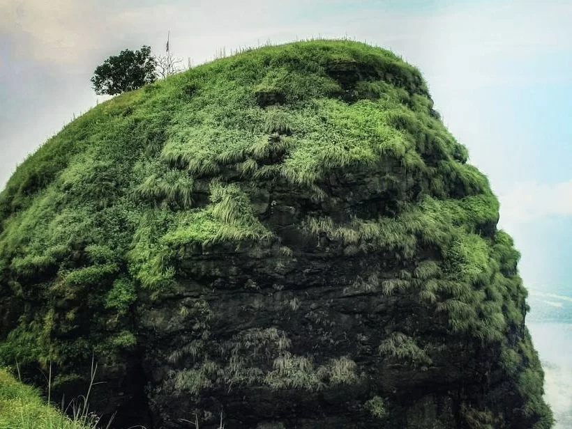
Sadhna Top, historically known as Nastachun Pass, is a high-altitude mountain pass standing at approximately 10,269 feet in the vast Shamsabari Range. Travelers visit this strategic location to experience the breathtaking gateway between the Kupwara district and the remote, picturesque valleys of Tangdhar and Teetwal, making it a vital crossing for those exploring the westernmost edges of the Kashmir Valley.
The on-ground atmosphere is characterized by dramatic weather shifts and an immense sense of verticality, as the pass remains snow-bound for much of the winter. In the summer, the environment transforms into a landscape of rugged mountain beauty, where visitors can witness the sheer engineering feat of the winding road and the watchful presence of the Indian Army, providing a safe and serene vantage point overlooking the deep, emerald-green valleys below.
What makes Sadhna Top distinct is its poignant history and its namesake, the legendary Bollywood actress Sadhana, who visited the troops here after the 1965 war. It offers an unparalleled 360-degree view of the jagged Himalayan peaks that form the Line of Control, providing a unique perspective where the raw, natural grandeur of the frontier meets the resilient cultural spirit of the border communities living in the Karnah sector.
Sadhna Top, originally known as Nastachun Pass, is a high-altitude mountain pass situated at an elevation of approximately 3,150 meters (10,335 feet) in the Kupwara district of Jammu and Kashmir. It serves as the primary gateway connecting the remote border towns of Tangdhar and Teetwal in the Karnah Valley to the rest of the Kashmir Valley, traversing the formidable Shamsabari Range.
Geographically, the pass is characterized by its steep, narrow gradients and heavy snowfall, which often reaches several feet during winter. It acts as a critical climatic barrier, with the weather at the summit often being significantly more severe than in the valleys below. The pass offers a panoramic view of the rugged, snow-clad Himalayan ridges that define the Line of Control (LoC) sector, making it one of the most scenic yet treacherous passes in the region.
Historically, the pass was renamed Sadhna Top in honor of the legendary Indian film actress Sadhana Shivdasani, who visited the site to boost the morale of Indian soldiers following the 1965 war. Today, it remains a site of immense strategic importance, heavily monitored and maintained by the Indian Army and the Border Roads Organization (BRO). It is a lifeline for the local population of the Karnah sector, though transit is often restricted during peak winter months due to the high risk of avalanches and landslides.
Sadhna Top, originally known as Nastachun Pass, stands at 10,269 feet and serves as the vital gateway between the Kupwara plains and the remote border valleys of Tangdhar and Teetwal. While the Border Roads Organization strives to keep this strategic pass open year-round, its high altitude and exposure to the Shamsabari Range weather systems make travel highly dependent on current snowfall and road clearance status.
Sadhna Top, originally known as Nastachun Pass, is a high-altitude mountain pass situated at approximately 3,120m (10,236 ft) in the Kupwara district of Jammu and Kashmir. Located in the Shamsabari Range, it serves as the only road link connecting the remote border tehsils of Tangdhar and Teetwal to the rest of the Kashmir Valley.
 Valley
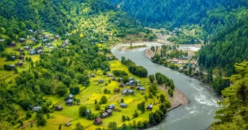
Keran Valley is a scenic Himalayan valley located in Kupwara district, Jammu and Kashmir, along the Kishanganga River near the Line of Control.
 Valley
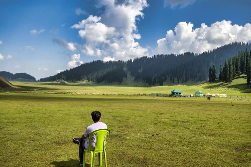
Bangus Valley is a high-altitude meadow valley located in Kupwara district, Jammu and Kashmir, known for its vast alpine grasslands surrounded by forested Himalayan mountains.
 Valley
Bungus Valley (also spelled Bangus) is a high-altitude Himalayan sub-valley situated at an elevation of approximately 3,048 meters (10,000 feet) in the northern Kupwara district.
Get customized Jammu and Kashmir tour planning designed around seasonal weather patterns, valley travel routes, snow conditions, and realistic hill road timing. Whether you are visiting for scenic landscapes, serene lakes, spiritual journeys, meadow stays
⚡ Quick Response | 💰 Free consultation | 🕒 24×7 expert support

