+91 9910402252
admin@chalbanjare.com
| Entry Fee | Free |
| Timings | Daytime Only |
| Altitude (m) | 2800 |
| Ideal Visit Duration (hrs) | 4 |
| Best Time of Day | Morning to Afternoon |
| Crowd Level | Very Low |
| Distance from Dawar (km) | 65 |
| Distance from Srinagar (km) | 190 |
| Walking Difficulty | Moderate |
| Parking Available | Limited |
| Last Mile Access | 4x4 Road |
| Suitable for Kids | Yes |
| Suitable for Seniors | Limited |
| Wheelchair Friendly | No |
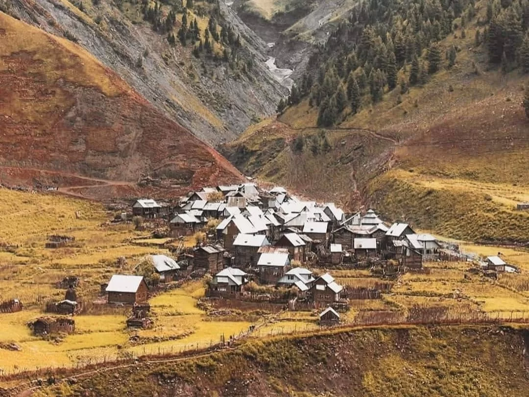
Chakwali is the final frontier village in the Tulail region of Gurez, standing as the last civilian settlement before the Line of Control. Travelers venture to this remote outpost to experience the absolute edge of the map, where the road literally ends and the raw, unpolished beauty of the high Himalayas takes over. It is a premier destination for those seeking to witness a traditional way of life that remains virtually untouched by modern commercialization.
The atmosphere in Chakwali is defined by a profound sense of stillness and the rhythmic sounds of the Kishanganga River. The village is characterized by its unique Shina-style architecture, featuring ancient wooden houses stacked closely together against the backdrop of massive, emerald-colored mountains. Visitors encounter a landscape where the air is extraordinarily pure and the hospitality of the Dard-Shin people offers a warm, human contrast to the rugged, high-altitude environment.
What makes Chakwali distinct is its role as the ultimate gateway to the hidden alpine meadows and glacial streams of the upper Gurez Valley. It offers a rare opportunity to see the traditional "log-cabin" lifestyle of the border tribes who have lived in harmony with these harsh winters for centuries. Standing in Chakwali provides a unique perspective on the geography of the partition, making it an essential stop for travelers interested in frontier history and the pristine, end-of-the-road wilderness of Jammu and Kashmir.
Chakwali is a remote border village situated at an elevation of approximately 3,350 meters (10,990 feet) in the Tulail Valley of the Gurez sector, Bandipora district. It is recognized as the last inhabited village on the Indian side of the Line of Control (LoC) in this region, marking the far eastern edge of the Gurez Valley where the Kishanganga River flows deep within the rugged Himalayan terrain.
Geographically, Chakwali is nestled in a narrow, high-altitude valley surrounded by massive snow-capped peaks of the Kishanganga range. The landscape is characterized by pristine alpine meadows and dense coniferous forests that remain isolated from the outside world for nearly six months of the year due to heavy snowfall at Razdan Pass. The village serves as a terminal point for the road network in Tulail, beyond which lies the high-altitude wilderness and the sensitive border ridge.
Historically, Chakwali is home to the Shina-speaking Dardi community, descendants of ancient Indo-Aryan tribes who have inhabited these mountains for centuries. The village reflects a unique cultural heritage that has remained largely untouched by modern urbanization, preserving traditional wooden architecture and a pastoral lifestyle centered around livestock and high-altitude farming. Today, it is of significant strategic importance and is closely monitored by the Indian Army. It is increasingly becoming a point of interest for extreme off-beat travelers looking to explore the furthest reaches of the Gurez Valley, though access requires strict military clearances and permits.
Chakwali, the last inhabited village in the Tulail Valley of Gurez, is a remote frontier destination located at approximately 11,500 feet. Accessibility is strictly seasonal, dictated by the opening of the Razdan Pass and the subsequent clearance of snow along the rugged riverside tracks of the Kishanganga, making it one of the most time-sensitive travel destinations in Jammu and Kashmir.
Chakwali is the final frontier of the Gurez Valley, recognized as the last inhabited village on the Indian side of the Line of Control (LoC) in the Tulail region. Located approximately 65 km beyond Dawar, it sits at an elevation of about 2,850m (9,350 ft) and offers a rare glimpse into the traditional Dard-Shina culture amidst untouched alpine scenery and the Kishanganga River.
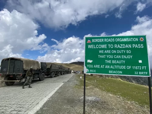 Mountain Pass
Razdan Pass is a high-altitude mountain pass connecting Bandipora to Gurez Valley in Jammu and Kashmir.
 Mountain
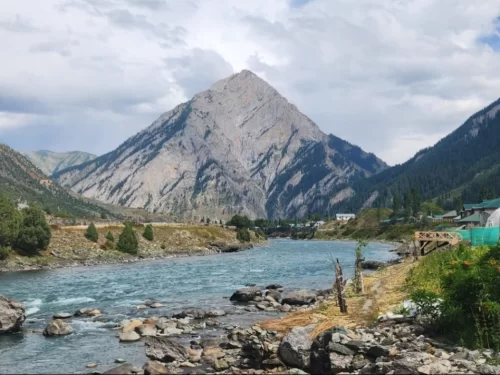
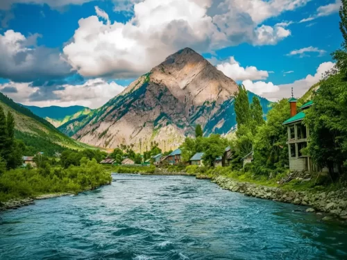
Habba Khatoon is a distinctive pyramid-shaped mountain peak situated at an elevation of approximately 3,962 meters (13,000 feet) in the Dawar region of Gurez Valley.
 Adventure Park
The Kishanganga River, also known as the Neelum River in Pakistan-administered Kashmir, is a significant tributary of the Jhelum River, originating from the high-altitude glaciers near Krishansar Lake and Sonamarg.
Get customized Jammu and Kashmir tour planning designed around seasonal weather patterns, valley travel routes, snow conditions, and realistic hill road timing. Whether you are visiting for scenic landscapes, serene lakes, spiritual journeys, meadow stays
⚡ Quick Response | 💰 Free consultation | 🕒 24×7 expert support

