+91 9910402252
admin@chalbanjare.com
| Entry Fee | Free |
| Timings | 00:00 - 23:59 |
| Altitude (m) | 1560 |
| Ideal Visit Duration (hrs) | 1 |
| Best Time of Day | Morning |
| Crowd Level | Low |
| Distance from City Centre (km) | 0 |
| Walking Difficulty | Easy |
| Parking Available | No |
| Last Mile Access | Road |
| Suitable for Kids | Yes |
| Suitable for Seniors | Yes |
| Wheelchair Friendly | No |
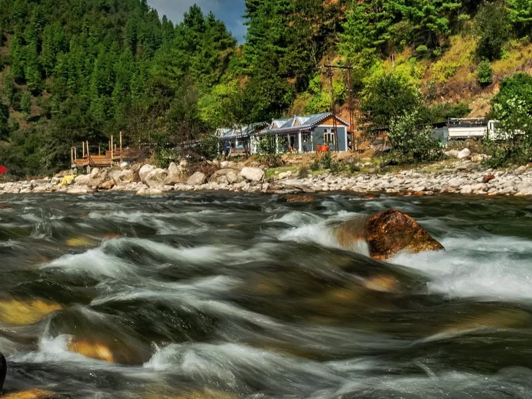
Visitors come to Dirang Chu River in Dirang mainly because the river flows directly through the town and is easily visible during a normal walk or drive. Travelers passing through Dirang on the route between Bomdila and Tawang often stop briefly near bridges to observe the river and the surrounding valley landscape.
The on-ground atmosphere around Dirang Chu River is quiet and typical of a small Himalayan valley town. The river moves steadily through the valley with local houses, farms, and forested hills on both sides, and daily life in Dirang continues around the bridges and roadside areas near the water.
What makes Dirang Chu River distinct for travelers is its role in shaping the layout of Dirang town and the valley scenery visible from nearby viewpoints. The river is not a standalone attraction but a natural feature travelers encounter while exploring Dirang, crossing town bridges, or continuing their journey toward higher mountain routes in Arunachal Pradesh.
Dirang Chu River has long been the central natural feature of the Dirang valley in West Kameng district of Arunachal Pradesh. The river flows through Dirang town and has historically supported settlement in the valley by providing water for agriculture, livestock, and daily household use.
Communities living in the Dirang valley, including the Monpa people, have traditionally depended on the river and nearby streams for farming and small-scale irrigation. Terraced fields and village areas developed along the valley where the river passes, shaping the layout of Dirang and nearby settlements.
Today Dirang Chu River continues to define the landscape of Dirang town, with roads, bridges, and residential areas built around the valley floor. Travelers visiting Dirang encounter the river naturally while crossing town bridges or moving along the highway toward Bomdila or Tawang.
Dirang Chu River can be seen throughout the year as it flows through Dirang town, but the overall visiting experience depends on seasonal weather in the West Kameng region. Clearer skies and stable road conditions outside the monsoon months make it easier for travelers to stop along bridges or viewpoints and observe the river valley.
 Tourist Attraction
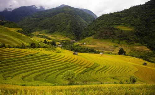
The Sangti Valley Paddy Fields are a network of traditional terraced agricultural landscapes located in Sangti Valley near Dirang, West Kameng district, Arunachal Pradesh.
 Viewpoint
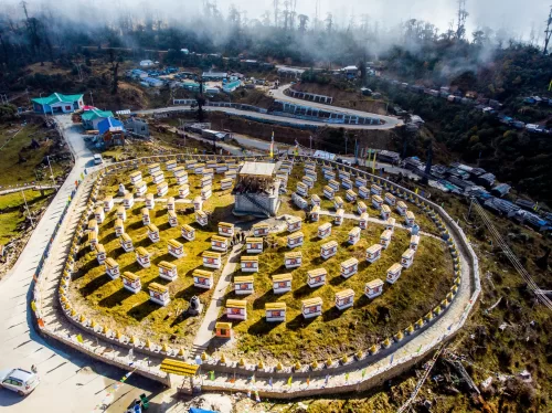
Mandala Top is a high-altitude mountain viewpoint located near Dirang in West Kameng district, Arunachal Pradesh, known for its collection of 108 Buddhist stupas and panoramic Himalayan landscapes.
 Valley
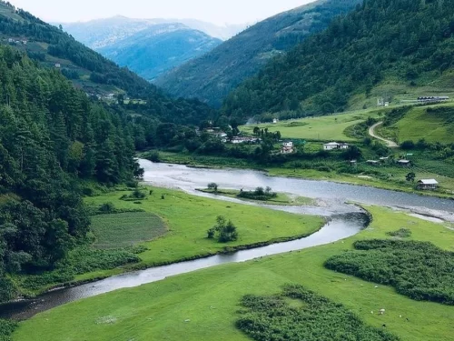
Sangti Valley Dirnah is a tranquil Himalayan valley near Dirang, known for its scenic beauty, river views, and seasonal birdwatching opportunities.
Get customized Arunachal Pradesh tour planning designed around mountain road distances, permit requirements, seasonal weather windows, and realistic travel pacing. Whether you are visiting for monasteries, high-altitude passes, river valleys, tribal cultu
⚡ Quick Response | 💰 Free consultation | 🕒 24×7 expert support

