+91 9910402252
admin@chalbanjare.com
| Entry Fee | No entry fee for visiting the town and river confluence area |
| Timings | Open throughout the day; nearby temples follow specific opening and closing hours |
| Altitude (m) | Approximately 895 m above sea level |
| Ideal Visit Duration | 1–2 hours for confluence viewpoint; longer if visiting temples and nearby sites |
| Best Time of Day | Early morning or late afternoon for clear views and better lighting |
| Crowd Level | Low to moderate; increases during pilgrimage seasons and festivals |
| Distance from City Centre (km) | 0 km (central town location) |
| Walking Difficulty | Easy to moderate; some uneven paths near river confluence areas |
| Parking Available | Yes, limited parking spaces available along roadsides and nearby open areas |
| Last Mile Access | Direct road access; short walking distance required to reach river confluence viewpoints |
| Suitable for Kids | Yes, with supervision near riverbanks |
| Suitable for Seniors | Yes, generally accessible with caution on uneven surfaces |
| Wheelchair Friendly | Partially accessible; main town areas are navigable but riverfront access is limited |
Travelers visit
On the ground,
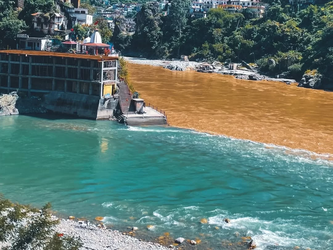
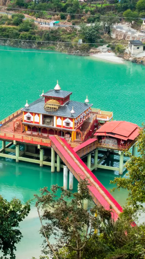
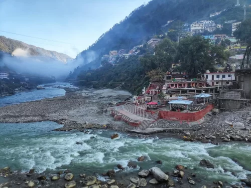
Rudraprayag is one of the five sacred confluences of the Panch Prayag, located at the meeting point of the Alaknanda and Mandakini rivers. This geographical junction has long held importance as a natural and spiritual landmark in the Garhwal Himalayas.
The town derives its name from Lord Shiva, worshipped here in his Rudra form. Local tradition is associated with mythological narratives linking this confluence to divine appearances and penance, which have shaped its religious identity over centuries.
Rudraprayag has historically served as a key transit point for pilgrims traveling toward Kedarnath. Its location along traditional Himalayan pilgrimage routes has contributed to its longstanding role in regional religious movement and settlement.
Rudraprayag is best visited during the pre-monsoon and post-monsoon windows when travel routes remain stable and the confluence views of the Alaknanda and Mandakini rivers are clearly visible, making it ideal for pilgrimage stopovers and Himalayan road journeys.
 Temple
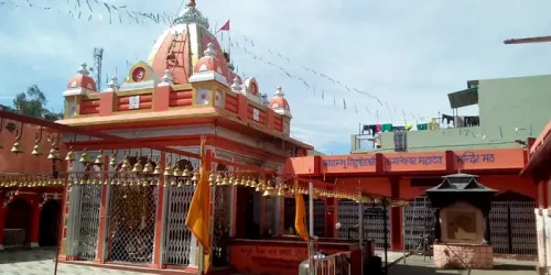
Dhari Devi Temple is a Hindu temple dedicated to Goddess Dhari Devi, situated on the banks of the Alaknanda River in Uttarakhand, India.
 Temple
Kamleshwar Mahadev Temple is an ancient Hindu temple dedicated to Lord Shiva, located in Srinagar Garhwal, Uttarakhand, India.
 Tourist Attraction
Karnaprayag is a town in Uttarakhand known as one of the five sacred confluences (Panch Prayag) of the Alaknanda and Pindar rivers.
Get customized Uttarakhand tour planning designed around seasonal weather changes, hill road travel timing, pilgrimage flow, and comfort-based pacing. Whether you are visiting for spiritual journeys, Himalayan views, wildlife reserves, river valleys, or p
⚡ Quick Response | 💰 Free consultation | 🕒 24×7 expert support

