Quick Facts About Karnaprayag
Karnaprayag Quick Facts
| Entry Fee | No entry fee |
| Timings | Open 24 hours; local temples may have specific visiting hours |
| Altitude (m) | Approximately 860 m |
| Ideal Visit Duration | 1–2 hours for the confluence area and nearby temples |
| Best Time of Day | Morning or late afternoon |
| Crowd Level | Low to moderate; higher during Char Dham pilgrimage season |
| Distance from City Centre (km) | 0 km (town centre location) |
| Walking Difficulty | Easy |
| Parking Available | Yes, limited roadside and town parking available |
| Last Mile Access | Directly accessible by road; short walk required to reach the confluence viewpoint |
| Suitable for Kids | Yes |
| Suitable for Seniors | Yes, with caution near riverbanks and steps |
| Wheelchair Friendly | Partially; town roads are accessible but access to riverfront areas may be limited |
Why Visit Karnaprayag, Uttarakhand
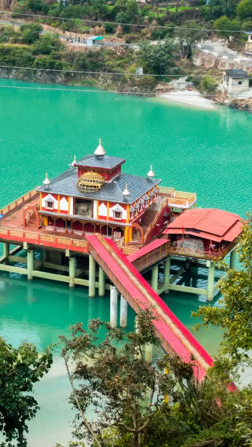
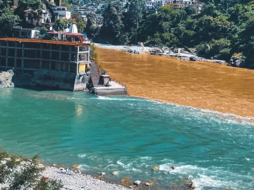
Visitors come to Karnaprayag to experience one of Uttarakhand’s sacred river confluences, where the Alaknanda and Pindar rivers meet. It also serves as an important stop for travelers heading toward the Garhwal Himalayas and the Char Dham region.
The town has a calm riverside atmosphere shaped by local markets, pilgrimage activity, and everyday mountain life. The surrounding hills, riverbanks, and road journeys offer continuous views of the central Himalayan landscape.
What makes Karnaprayag distinct is its role as a living confluence town rather than a dedicated tourist destination. Travelers can observe local culture, witness the meeting of two Himalayan rivers, and explore a lesser-commercialized part of Uttarakhand’s mountain region.
History of Karnaprayag, Uttarakhand
Karnaprayag is one of the five sacred river confluences known as the Panch Prayag in Uttarakhand. Situated at the confluence of the Alaknanda and Pindar rivers, the town has long been an important stop on traditional pilgrimage routes in the Garhwal Himalayas.
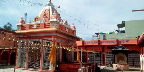
The name Karnaprayag is linked to Karna, a prominent figure from the Mahabharata. According to local tradition, Karna performed penance and worshipped the Sun God at this confluence. This association has given the town enduring religious significance and continues to attract pilgrims throughout the year.
Over time, Karnaprayag developed as a spiritual and transit center for travelers journeying toward the higher Himalayan shrines. Its sacred river confluence remains the focal point of the town’s historical and cultural identity.
Best Time to Visit Karnaprayag, Uttarakhand
The most comfortable time to visit Karnaprayag is from October to March, when clear skies, pleasant daytime temperatures, and good visibility make it suitable for sightseeing, temple visits, and exploring the Alaknanda–Pindar river confluence.
- Ideal Months: October to March offers the most favorable conditions for general tourism and photography.
- Best Season Weather: Post-monsoon and winter months typically bring clear mountain views, cool mornings and evenings, and comfortable daytime temperatures.
- Periods to Avoid: July to September can experience heavy monsoon rainfall, increasing the risk of landslides, road disruptions, and reduced visibility on mountain routes.
How to Reach Karnaprayag, Uttarakhand
- By Air: The nearest airport is Jolly Grant Airport, Dehradun, located about 190 km from Karnaprayag. Regular flights connect Dehradun with major Indian cities. Taxis and shared vehicles are available from the airport for onward travel to Karnaprayag.
- By Train: The nearest railway station is Rishikesh Railway Station, approximately 170 km away. Haridwar Junction, about 195 km away, offers broader rail connectivity with major cities across India. Taxis and buses are available from both stations.
- By Road: Karnaprayag is situated on National Highway 7, the main route connecting Rishikesh, Rudraprayag, Chamoli, Joshimath, and Badrinath. Regular buses, shared jeeps, and private taxis operate from major towns in Uttarakhand. Road travel remains the most practical way to reach the town, though monsoon weather can occasionally affect mountain road conditions.
What to Expect When You Visit Karnaprayag, Uttarakhand
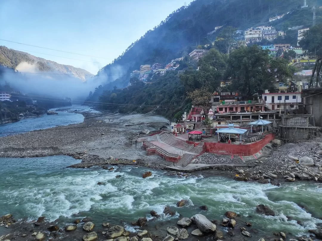
- Karnaprayag is a small Himalayan town situated at the confluence of the Alaknanda and Pindar rivers, with a mix of residential areas, local markets, temples, and roadside facilities serving travelers moving through the Garhwal region.
- Basic amenities such as hotels, guesthouses, restaurants, pharmacies, ATMs, fuel stations, and local transport services are available, though options are more limited compared to larger Uttarakhand towns.
- The town is located along a major mountain highway, making it accessible by road throughout most of the year. Movement within the town is generally on foot, with some steep sections, narrow roads, and uneven pathways near riverbanks and temple areas.
- Visitors typically stop for religious visits, river confluence viewing, rest breaks, or overnight stays while traveling toward destinations such as Badrinath, Joshimath, Gwaldam, and nearby Garhwal towns.
- Traffic congestion can occur during pilgrimage seasons and holiday periods. Road travel may experience delays during heavy rainfall, landslides, or adverse weather conditions common in the monsoon months.
- The atmosphere is generally quiet and local in character, with limited nightlife or entertainment facilities. Most activity is concentrated around the market area, transport junctions, and religious sites.
Important Visitor Information for Karnaprayag, Uttarakhand
- Karnaprayag experiences its highest visitor numbers during the Char Dham Yatra season, particularly from May to June and September to October, when pilgrims and travelers pass through the town en route to higher Himalayan destinations.
- Early mornings generally offer clearer mountain views, lighter traffic, and a more peaceful atmosphere around the confluence of the Alaknanda and Pindar rivers, while afternoons can be busier with passing vehicles and tour groups.
- Monsoon months from July to August can bring heavy rainfall, slippery surfaces, reduced visibility, and occasional road disruptions on mountain routes leading to and from Karnaprayag.
- Visitors planning to visit local temples should wear modest clothing that covers shoulders and knees, as these religious sites continue to serve local worshippers and pilgrims.
- Exercise caution near riverbanks and rocky areas around the sangam, especially during the monsoon season when water levels and currents can rise rapidly.
- Mountain roads approaching Karnaprayag contain sharp bends and steep sections; travelers driving themselves should allow extra travel time and avoid unnecessary night driving during adverse weather conditions.
Photography and Viewpoints at [PLACE NAME]
- Key photography opportunities at [PLACE NAME] are typically found from its main viewpoints, elevated sections, approach roads, riverbanks, open landscapes, heritage structures, or designated observation areas, depending on the site's terrain and layout.
- Early morning generally provides the clearest visibility, softer light, and fewer visitors, while late afternoon offers warmer tones and better depth for landscape photography.
- Photographers visiting during peak tourist hours may encounter crowds at popular viewing spots, which can affect composition and waiting times for unobstructed shots.
- Seasonal conditions such as mist, monsoon clouds, snow cover, flowering landscapes, or clear mountain views can significantly influence photographic results throughout the year.
- Photography restrictions may apply inside religious areas, protected monuments, government-controlled zones, museums, or locations where flash photography is prohibited.
- Access to certain viewpoints may require short walks, stair climbs, uneven paths, or favorable weather conditions, particularly during the rainy season.