


Uttarakhand in January – Weather, Snowfall & Travel Guide
Plan a January trip to Uttarakhand with practical information on weather, snowfall, temperatures, road conditions, places to visit and winter activities.
+91 9910402252
admin@chalbanjare.com


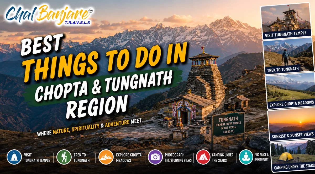
The Chopta and Tungnath region offers Himalayan trekking, ancient temples, alpine meadows, breathtaking viewpoints, camping experiences, and some of Uttarakhand's most scenic mountain landscapes.
Tungnath Temple stands at an altitude of about 3,680 metres in the Garhwal Himalayas and is widely regarded as the highest Shiva temple in the world. It is one of the Panch Kedar temples and is reached through a mountain trail beginning near Chopta. The route gradually rises through open meadows, rhododendron patches, stone-paved sections, and broad slopes that reveal views of major Himalayan peaks. The temple itself is compact and built in a traditional stone style, creating a powerful contrast against the wide mountain landscape surrounding it.
The journey is not only a religious visit but also one of the most scenic short treks in Uttarakhand. As travellers climb higher, the forested surroundings of Chopta begin to open into alpine terrain with distant views of peaks such as Chaukhamba, Kedarnath, Neelkanth, and parts of the Garhwal range. Weather conditions can change quickly at this altitude, so clear mornings generally offer the most reliable visibility. Even during the main season, clouds, mist, cold winds, and light rain can develop by afternoon.
The Tungnath trek offers one of the clearest examples of how spirituality and mountain travel come together in Uttarakhand. Visitors should allow enough time to walk slowly, rest at regular intervals, and observe the changing landscape rather than treating the route as a quick climb. The temple area can become crowded during weekends, festivals, and peak summer months, while early mornings usually provide a quieter and more atmospheric experience.
The trek from Chopta to Tungnath is approximately 3.5 to 4 kilometres one way, depending on the exact starting point and trail conditions. Although the distance is moderate, the continuous uphill gradient and high altitude make the walk more demanding than an ordinary hill trail. The path is largely well defined and includes paved stone sections, earthen stretches, and steeper bends near the upper slopes. People with basic fitness can usually complete the trek, but those not accustomed to altitude should move slowly and avoid rushing.
Seasonal conditions strongly influence the difficulty of the route. During late spring and early summer, the trail is generally accessible but may remain wet, muddy, or partially covered with snow near the upper section. Monsoon months bring slippery surfaces, reduced visibility, and a greater possibility of road interruptions. Autumn usually offers clearer skies and stable walking conditions, while winter snowfall can cover the trail completely and make the temple inaccessible without proper snow equipment, local guidance, and suitable weather.
Travellers should plan the Tungnath trek according to the season rather than relying only on the short distance. A slow pace, proper footwear, and an early departure improve both safety and comfort. Families with older children and active seniors may attempt the route with sufficient breaks, but anyone with breathing difficulty, knee problems, or poor endurance should evaluate the climb carefully before starting.
The Tungnath journey is distinct because the sense of pilgrimage develops gradually along the trekking route. Bells, prayer flags, small shrines, and groups of pilgrims appear against open Himalayan slopes, while the sound of wind and distant temple chants adds to the atmosphere near the summit area. Unlike a temple reached directly by road, Tungnath requires physical effort, patience, and time, which makes the arrival feel more meaningful for many visitors.
At the same time, the route provides a strong mountain adventure experience. The changing altitude, exposed ridges, sudden cloud movement, and wide views create a feeling of remoteness despite the trail being popular. Travellers often pause at natural viewpoints, meadow edges, and bends where the landscape opens towards deep valleys and snow-covered peaks. The combination of religious importance and outdoor challenge makes Tungnath suitable for pilgrims, trekkers, photographers, and travellers interested in Himalayan culture.
Tungnath is most rewarding when approached as both a sacred destination and a mountain environment that demands care. Travellers should respect temple customs, avoid leaving waste on the trail, and remain aware that weather conditions can change within minutes. Allowing enough time for prayer, rest, photography, and quiet observation creates a more complete experience than simply reaching the temple and returning immediately.
Chandrashila Summit rises above Tungnath at an altitude of roughly 4,000 metres and provides one of the broadest accessible viewpoints in the Chopta region. From the summit area, clear weather can reveal a sweeping line of Himalayan peaks, including Chaukhamba, Kedarnath, Neelkanth, Nanda Devi, Trishul, and several surrounding ridges. The final viewpoint is open and exposed, allowing travellers to look across deep valleys, high mountain slopes, and distant snow-covered ranges from multiple directions.
The quality of the view depends heavily on weather and timing. Early mornings generally offer the best chance of clear skies before clouds begin to rise from the valleys. Visibility may change within minutes, especially during pre-monsoon and monsoon periods. The summit itself is not a large developed platform, so visitors should move carefully on uneven, rocky ground and avoid standing too close to exposed edges during strong winds, snow, or low visibility.
The summit experience is most impressive when travellers arrive with enough time to observe the full mountain panorama rather than taking only a few quick photographs. Warm layers are essential because the temperature at the top can feel much colder than Chopta or Tungnath. Even on sunny days, strong wind can reduce comfort and make prolonged standing difficult.
The route from Tungnath Temple to Chandrashila is shorter than the main Chopta to Tungnath trail, but it is steeper and more physically demanding. The final section is usually about 1.5 kilometres one way and climbs rapidly through rocky, narrow, and exposed terrain. The path may be clearly visible in dry conditions, but snow, fog, and loose stones can make route identification and footing more difficult. Travellers who feel exhausted at Tungnath should rest before deciding whether to continue.
The altitude increase between Tungnath and Chandrashila is significant over a short distance, which can make breathing more difficult. The trail has limited shade and almost no dependable shelter, so trekkers are directly exposed to sunlight, wind, rain, or snowfall. Seasonal food stalls are generally absent beyond Tungnath, making it important to carry sufficient water and a light energy snack. During snow-covered periods, local guidance may be necessary because the regular trail can become hidden.
The final climb should not be attempted only because it appears short on a map. Travellers should consider breathing comfort, visibility, wind speed, remaining daylight, and trail condition before leaving Tungnath. Turning back is the safer decision when clouds become dense, snowfall increases, or fatigue begins to affect balance and concentration.
Sunrise from Chandrashila is one of the most sought-after experiences in the Chopta region because the first light gradually illuminates the surrounding Himalayan peaks. The colour change usually begins before the sun appears, with dark ridges becoming visible against the early sky before higher snow-covered summits catch golden light. The experience is weather dependent, and cloud cover, fog, snowfall, or haze can block the view even after an early start.
Reaching the summit for sunrise often requires beginning the trek before daylight, either from Chopta or from accommodation located near the trailhead. Walking in darkness introduces additional challenges, including icy patches, poor depth perception, and difficulty identifying the correct path. A reliable headlamp, warm clothing, proper shoes, and local awareness are important. Travellers should avoid relying only on a mobile phone torch, especially in cold conditions where battery performance may drop quickly.
A Chandrashila sunrise is memorable because it combines physical effort, silence, cold conditions, and the gradual appearance of the Himalayan landscape. Visitors should remain flexible and understand that a clear sunrise cannot be guaranteed. Even when the peaks remain partly covered, the high-altitude atmosphere, changing sky, and early morning views across the valleys can still make the climb worthwhile.
Chopta is surrounded by open alpine meadows locally known as bugyals, along with dense forests of deodar, oak, and rhododendron. The meadows spread across gently rising slopes below the Tungnath trail and create broad natural viewpoints towards the Garhwal Himalayas. During clear weather, travellers can see distant snow-covered peaks beyond the green landscape, while forest edges provide shaded walking areas and quieter spaces away from the main roadside zone.
The appearance of the meadows changes with altitude, weather, and season. Lower areas near the road are more accessible and may have seasonal camps, small food stalls, and parked vehicles, while higher slopes feel quieter and more open. Morning light usually provides clearer mountain views, whereas mist and cloud often move across the grasslands later in the day. Visitors should remain on visible paths where possible because wet grass, uneven ground, and hidden stones can make walking difficult.
The alpine meadows are best explored slowly, with time for short walks, mountain observation, and quiet breaks near the forest edge. Visitors do not need to follow a demanding route to experience the landscape, but suitable shoes remain important because the ground can be damp and irregular. Respecting marked paths and keeping noise low helps protect the natural setting and preserves the peaceful atmosphere.
Short walks around Chopta offer an easier alternative to the steeper Tungnath and Chandrashila climbs. Travellers can follow meadow edges, forest tracks, and gentle roadside trails that pass through shaded woodland and open viewpoints. These walks are suitable for people who want to enjoy the mountain environment without committing to a full-day trek, though the altitude and sloping terrain can still cause quicker fatigue than expected.
The quieter paths are most enjoyable in the early morning or late afternoon when vehicle movement is lower and the forests are more active with birds. Walkers may hear wind moving through the trees, distant bells from grazing animals, and seasonal bird calls. Some tracks are informal and may not have signs, so travellers should avoid moving too far into dense forest without local knowledge, especially during fog, snowfall, or fading daylight.
Peaceful walking in Chopta is less about covering distance and more about experiencing the changing forest, open grasslands, and mountain views. Travellers should choose routes according to daylight, weather, and comfort rather than following unmarked tracks. Carrying water and returning before darkness makes these short explorations safer and more enjoyable.
Chopta’s meadows display strong seasonal variation throughout the year. Spring brings fresh grass, blooming rhododendrons, and lingering snow on higher slopes. Early summer offers greener landscapes and generally easier access, while the monsoon deepens the colour of the meadows but also creates muddy ground, low visibility, and more frequent road disruptions. Autumn usually brings clearer skies, crisp air, and golden or brown tones across the grasslands.
Winter transforms the region into a snow-covered landscape, often making normal meadow walks difficult without proper footwear and local guidance. Road access can become uncertain after heavy snowfall, and many seasonal businesses close. Travellers should therefore treat Chopta as a different destination in each season rather than expecting the same conditions throughout the year. Clothing, transport planning, and activity choices should be adjusted according to the actual weather.
Understanding seasonal change helps travellers choose the right experience in Chopta. Those seeking green meadows may prefer late spring or early summer, while clearer mountain views are often associated with autumn. Snow travellers need more preparation, flexible transport plans, and realistic expectations about limited facilities and difficult walking conditions.
Deoria Tal is a small high-altitude lake located above Sari village in the Chopta region. The lake sits at roughly 2,400 metres and is reached by a short uphill trek through village surroundings and forested slopes. It is known for its quiet setting, open meadow edges, and wide views towards the Chaukhamba range during clear weather. The landscape feels especially peaceful in the morning before day visitors begin arriving.
The lake is smaller than many travellers expect, but its location makes it visually distinctive. Tall trees frame parts of the shoreline, while open sections provide uninterrupted views towards the mountains. Weather conditions can change quickly, and clouds often reduce visibility by afternoon. Visitors should avoid entering the water, disturbing the shoreline, or leaving food waste because the area is ecologically sensitive and has limited waste-management facilities.
Deoria Tal is most rewarding for travellers who appreciate quiet landscapes rather than large attractions or developed tourist facilities. The lake visit can be completed as a half-day experience, though staying longer allows better observation of changing light and mountain views. Carrying water and basic snacks remains advisable, especially outside busy travel periods.
The most common route to Deoria Tal begins from Sari village and covers roughly 2 to 2.5 kilometres one way. The trail starts near village homes and small shops before climbing steadily through stone-paved sections, forest patches, and open bends. Although the distance is short, the continuous uphill gradient can be tiring for people with limited fitness. Most visitors require around one to two hours to reach the lake, depending on pace and rest stops.
The route is generally well used, but rain, snow, and loose stones can make sections slippery. Horses or mules may sometimes be available, though availability and rates vary by season. Early morning trekking is preferable because temperatures are cooler and visibility is usually better. Travellers should remain alert on narrow turns, especially when animals or groups are moving along the same path.
The Deoria Tal route is suitable for many first-time trekkers, families with active children, and older travellers who can manage steady climbing. A slow pace and regular breaks reduce fatigue, while good-grip footwear improves safety. Visitors should not underestimate the route simply because it is short, particularly during wet or snowy conditions.
Deoria Tal is widely associated with reflections of the Chaukhamba peaks on its surface, but the reflection depends on calm water, clear skies, and suitable light. Early morning provides the strongest possibility because winds are usually lighter and the mountains are less likely to be covered by cloud. Even then, perfect reflections are not guaranteed, especially during unstable weather or periods of strong visitor movement around the shoreline.
Photographers often find the most balanced compositions from open sections where the lake, trees, and mountain backdrop can be included together. The shoreline should be approached carefully because some edges can be soft, muddy, or slippery. Tripods should be placed on stable ground without damaging plants. Visitors should also avoid throwing objects into the water or entering restricted areas simply to create a clearer view.
Photography at Deoria Tal requires patience because light, wind, and cloud conditions can shift rapidly. Reaching the lake early and allowing time for the landscape to change gives a better chance of capturing reflections than arriving briefly during midday. Even without a clear reflection, the combination of forest, meadow, water, and Himalayan peaks remains visually rewarding.
The Chopta region offers one of the most varied trekking environments in Uttarakhand, combining dense temperate forests, rolling alpine meadows, rocky mountain trails, and high-altitude ridgelines. Unlike destinations focused on a single trek, Chopta serves as a gateway to multiple hiking routes that differ in length, elevation gain, and overall difficulty. Trails range from short walks around meadow areas to full-day mountain hikes, allowing travellers with different experience levels to explore the Garhwal Himalayas at their own pace.
Most trekking routes begin from Chopta or nearby villages and gradually pass through changing landscapes. Lower sections remain shaded beneath oak, rhododendron, and deodar forests, while higher elevations become more open with broad grasslands and panoramic Himalayan views. The condition of these trails depends heavily on recent weather, with rain making soil sections slippery and winter snowfall transforming familiar paths into more demanding mountain routes. Trekkers should always begin early to allow enough daylight for the return journey.
Trekking around Chopta is rewarding because every route reveals a different aspect of the Himalayan landscape. Whether choosing a short forest walk or a challenging summit climb, travellers benefit from allowing extra time for rest, photography, and changing weather. A flexible itinerary is often more enjoyable than trying to complete several trails within a single day.
Not every trekking route around Chopta suits every traveller. While some walks remain relatively gentle and suitable for beginners, others require sustained uphill climbing at high altitude. Travellers should evaluate their physical condition honestly before selecting a trail rather than choosing only according to popularity. Altitude, steep gradients, and rapidly changing weather often make mountain treks feel more demanding than their distance suggests.
Season also plays an important role in route selection. Spring and autumn generally provide the most reliable trekking conditions, while monsoon introduces slippery surfaces and occasional road disruptions. Winter attracts snow enthusiasts but requires appropriate footwear, warm clothing, and awareness of snow-covered trails. Families with children or senior travellers may prefer shorter routes and avoid high-altitude climbs during difficult weather conditions.
Choosing an appropriate trekking route ensures a safer and more enjoyable experience. Visitors should match the trail with their fitness, available daylight, and current weather rather than attempting difficult hikes without preparation. Mountain conditions can change unexpectedly, making flexibility one of the most valuable aspects of successful trekking in Chopta.
Outdoor exploration around Chopta extends beyond reaching famous destinations. Many travellers spend time observing mountain ecosystems, following quiet forest paths, resting in alpine meadows, and appreciating panoramic viewpoints along the way. The region offers opportunities to slow down and experience Himalayan landscapes without the crowds often found at more commercial hill stations.
The natural environment rewards careful observation throughout the journey. Seasonal flowers, changing forest colours, bird activity, and shifting cloud formations create a different experience every few kilometres. Visitors should maintain awareness of altitude, weather, and trail conditions while respecting the fragile mountain ecosystem. Responsible trekking ensures these landscapes remain protected for future travellers and local communities alike.
Outdoor exploration in Chopta is most rewarding when travellers focus on the complete mountain experience rather than only reaching a destination. Forest silence, meadow landscapes, fresh mountain air, and changing Himalayan views create lasting memories that extend well beyond any single trekking route.
Camping in the Chopta region allows travellers to spend a night within the Himalayan landscape instead of returning immediately after a trek. Campsites are generally located near meadows or forest edges where visitors can experience mountain sunsets, cool evening temperatures, and early morning Himalayan views. Depending on the season, accommodation ranges from organised tent camps with basic facilities to designated camping areas managed by local operators.
Most camping locations are selected to minimise environmental impact while providing access to trekking routes such as Tungnath and Chandrashila. Camp areas usually offer open surroundings rather than dense forest interiors, reducing disturbance to wildlife and improving safety. Temperatures drop rapidly after sunset throughout much of the year, making warm clothing essential even during seasons with pleasant daytime weather.
Camping adds a different dimension to the Chopta experience by allowing visitors to observe mountain landscapes beyond daylight hours. Spending the night in the Himalayas provides opportunities to enjoy changing skies, cooler temperatures, and early morning scenery before most day visitors arrive. Choosing authorised camps also supports responsible tourism and environmental protection.
Evenings in Chopta are generally quiet, with limited artificial lighting and very little traffic once day visitors leave the area. As temperatures fall, mountain silhouettes become more pronounced against the evening sky, creating a calm atmosphere around campsites. On clear nights, many visitors enjoy observing stars above the surrounding peaks, although cloud cover and moonlight influence visibility throughout the year.
The peaceful environment makes camping particularly appealing for travellers seeking a break from busy urban destinations. Conversations around dining areas, the sound of wind moving through nearby forests, and distant animal bells often replace city noise. Because wildlife inhabits the surrounding forests, campers should remain within designated areas after dark and avoid walking alone into unlit sections beyond the campsite.
Evenings in Chopta encourage travellers to slow down and appreciate the natural rhythm of the mountains. Rather than focusing on organised entertainment, the experience centres on fresh air, mountain views, quiet surroundings, and conversations shared beneath the Himalayan sky. Proper clothing and respect for campsite rules ensure a comfortable overnight stay.
Camping conditions in Chopta vary significantly throughout the year. Spring and autumn usually provide the most comfortable combination of stable weather and scenic landscapes, while early summer remains popular because trekking routes are widely accessible. During the monsoon, frequent rainfall may affect campsite conditions, increase humidity, and occasionally disrupt road access. Winter camping is possible only in selected locations and generally requires specialised preparation.
Many camps operate seasonally rather than throughout the year. Heavy snowfall may lead to temporary closure of campsites, while some facilities reduce services during quieter travel periods. Travellers should confirm accommodation availability before arrival, particularly during festivals, holiday weekends, or winter months when weather conditions may change quickly.
Successful camping in Chopta depends on understanding seasonal conditions before travelling. Visitors who prepare for changing temperatures, confirm campsite availability, and carry suitable clothing can enjoy a comfortable Himalayan overnight experience. Flexible travel plans remain valuable because mountain weather occasionally changes faster than forecasts predict.
The forests surrounding Chopta form part of the Kedarnath Wildlife landscape and are recognised for their rich Himalayan biodiversity. Dense oak, deodar, maple, and rhododendron forests provide ideal habitats for numerous bird species throughout the year. The changing elevation around Chopta allows birdwatchers to experience different ecosystems within a relatively short distance, making the region attractive for both experienced bird enthusiasts and casual nature lovers.
Morning hours are generally the most productive for birdwatching because birds become active shortly after sunrise while the forests remain quieter. As the day progresses, increasing visitor activity and changing weather conditions can reduce opportunities for wildlife observation. Walking slowly through forest trails while listening carefully often proves more rewarding than covering long distances quickly. Binoculars and patience are usually more valuable than attempting to reach multiple locations within a limited time.
Birdwatching in Chopta rewards patience rather than speed. Visitors who spend time quietly observing forest edges, meadow transitions, and higher woodland trails often experience greater wildlife diversity than those following a rushed sightseeing schedule. Respecting the natural habitat ensures both better wildlife encounters and long-term conservation of this Himalayan ecosystem.
Beyond birdlife, Chopta supports a wide variety of Himalayan plants, insects, butterflies, and mammals adapted to high-altitude environments. The vegetation changes noticeably with elevation, beginning with dense mixed forests before gradually opening into alpine grasslands near Tungnath. During spring and early summer, rhododendron flowers create colourful forest landscapes, while autumn highlights changing foliage across the mountain slopes.
Wild mammals generally remain difficult to observe because they avoid busy trekking routes and human activity. However, visitors may occasionally notice signs of wildlife such as tracks, distant movement, or calls within the forests. Nature exploration should always focus on observation rather than interaction. Removing flowers, collecting plants, or disturbing wildlife habitats reduces the ecological value of these protected mountain environments.
Nature exploration around Chopta offers far more than scenic viewpoints. Observing forest structure, seasonal vegetation, and wildlife habitats allows travellers to appreciate how different mountain ecosystems support remarkable biodiversity. Responsible behaviour helps preserve these landscapes for future visitors and local wildlife alike.
One of Chopta's greatest strengths is its ability to encourage slow travel through natural surroundings. Rather than following crowded tourist attractions, visitors can enjoy peaceful walks across forest trails, meadow edges, and quiet mountain paths where the journey itself becomes the primary experience. Gentle walking allows travellers to notice changing vegetation, birdsong, fresh mountain air, and panoramic Himalayan views that may otherwise be overlooked.
These nature walks require little specialised equipment beyond comfortable walking shoes, warm clothing, and drinking water. The emphasis remains on observation rather than physical challenge. Travellers should remain aware of weather changes and avoid wandering onto unmarked trails, particularly during fog or late afternoon when visibility decreases within forested sections.
Slow nature walks provide one of the most relaxing experiences available in Chopta. Travellers who spend time appreciating forests, birds, flowers, and mountain scenery often discover that the region offers lasting memories beyond its famous trekking routes. Allowing sufficient time for quiet exploration creates a deeper connection with the Himalayan environment.
Chopta offers exceptional photography opportunities because of its constantly changing combination of forests, alpine meadows, mountain ridges, and snow-covered Himalayan peaks. Unlike destinations where viewpoints remain concentrated in one location, photographic subjects appear throughout the journey. Travellers can capture dense rhododendron forests, winding trekking paths, grazing landscapes, dramatic cloud formations, and distant mountain ranges within a relatively small area.
Lighting conditions change rapidly at high altitude, making timing an important factor. Early morning usually provides the clearest visibility and softer light, while afternoon clouds frequently reduce distant mountain views. Photographers should remain prepared for sudden weather changes and protect equipment from rain, moisture, and dust. Walking carefully while carrying camera gear is equally important because many trails contain uneven stones and steep sections.
The best photographs in Chopta often result from patience rather than rushing between locations. Waiting for shifting clouds, changing sunlight, or quieter moments along trekking routes frequently produces stronger images than visiting multiple viewpoints in a limited time. Careful planning around weather and daylight greatly improves photographic results.
Chandrashila is widely regarded as the premier sunrise photography location in the Chopta region. Before sunrise, mountain silhouettes gradually emerge against the brightening sky before the first sunlight illuminates snow-covered Himalayan peaks. The changing colours during this short period provide unique photographic opportunities that vary every morning according to weather and atmospheric conditions.
Reaching the summit before sunrise requires an early departure, proper trekking equipment, and awareness of trail conditions. Photographers should arrive before first light to prepare equipment without rushing in cold, windy conditions. Even if cloud cover partially obscures the mountains, changing light across surrounding ridges and valleys often creates dramatic landscape images worth capturing.
Sunrise photography at Chandrashila combines technical preparation with mountain awareness. Success depends on reaching the summit safely, allowing time for changing light, and remaining flexible if weather conditions differ from expectations. Even without perfect visibility, the dramatic atmosphere of the high Himalayas often creates memorable images.
Every season transforms the visual character of Chopta. Spring introduces colourful rhododendron forests, summer highlights vibrant alpine meadows, monsoon produces dramatic mist-covered landscapes, autumn provides exceptionally clear Himalayan views, and winter covers the region in snow. These seasonal differences allow photographers to capture entirely different scenery while visiting the same locations at different times of the year.
Travellers should match photography goals with seasonal conditions rather than expecting identical landscapes throughout the year. While autumn generally offers the clearest mountain visibility, spring delivers colourful vegetation and winter creates striking snow-covered compositions. Monsoon photography requires extra protection for equipment but rewards visitors with dramatic clouds and lush green surroundings.
Seasonal photography in Chopta rewards travellers who understand how weather and landscape change throughout the year. Rather than searching for a single perfect viewpoint, photographers benefit from exploring different environments across forests, meadows, trekking routes, and mountain ridges while adapting to the unique conditions of each season.
The villages surrounding Chopta, including Sari, Dugalbitta, Baniyakund, Makku, and parts of the Ukhimath region, reflect the traditional lifestyle of the Garhwal Himalayas. These settlements are surrounded by terraced fields, forests, grazing lands, and mountain slopes where agriculture and livestock continue to play an important role in daily life. Houses are generally built using locally available stone and wood, designed to withstand the cold mountain climate while blending naturally with the surrounding landscape.
Unlike commercial hill stations, these villages have developed gradually around local communities rather than tourism alone. Visitors walking through the villages can observe traditional farming methods, small family-run guesthouses, village temples, and seasonal agricultural activities. Tourism provides an additional source of income, but village life continues to follow agricultural cycles, weather conditions, and religious traditions that have existed for generations. Exploring these settlements respectfully allows travellers to experience the cultural side of the Chopta region beyond its trekking routes.
Exploring the villages around Chopta offers a deeper understanding of life in the Garhwal Himalayas. Travellers who spend time interacting respectfully with local communities often gain valuable insight into mountain traditions, sustainable living, and the close relationship between people and their natural surroundings.
The lifestyle of the Chopta region reflects the challenges and opportunities of living in a high-altitude mountain environment. Daily routines are closely linked to farming seasons, livestock care, forest resources, and changing weather conditions. Hospitality remains an important part of village culture, and travellers staying in local guesthouses or homestays often experience warm interactions with residents who have lived in these mountains for generations.
Regional Garhwali cuisine is generally simple, nutritious, and prepared using locally available ingredients. Depending on the season and accommodation, visitors may have opportunities to try dishes prepared with local grains, lentils, leafy vegetables, and traditional cooking methods. Festivals, religious ceremonies, and community gatherings continue to preserve local customs, music, and cultural practices that remain closely connected to village life.
Experiencing the local lifestyle adds cultural depth to a Chopta journey. Rather than viewing the villages only as places to pass through, travellers who spend time learning about regional food, customs, and traditions often return with a richer understanding of Himalayan culture alongside their trekking memories.
The relationship between local communities and the surrounding natural environment has shaped life in the Chopta region for centuries. Forests provide essential resources, grazing lands support livestock, and seasonal weather determines agricultural activities throughout the year. Residents have traditionally adapted their lifestyle to the mountain ecosystem by using available natural resources carefully while respecting the limitations imposed by altitude and climate.
Modern tourism has created new economic opportunities, but maintaining ecological balance remains important for both local livelihoods and visitor experiences. Responsible tourism supports village economies while helping preserve forests, wildlife habitats, trekking routes, and traditional practices. Travellers who understand this connection are more likely to appreciate why environmental conservation plays such a significant role in the long-term future of the Chopta region.
Understanding how Himalayan communities live alongside nature helps visitors appreciate Chopta beyond its scenic beauty. Every forest, meadow, and village forms part of an interconnected mountain ecosystem where responsible travel supports cultural preservation as well as environmental conservation. Respectful interaction leaves a positive impact on both travellers and local residents.
Planning a trip to Chopta and Tungnath begins with selecting activities that match the season, personal fitness, and travel expectations. Adventure enthusiasts often prioritise trekking to Tungnath and Chandrashila, while nature lovers may prefer exploring alpine meadows, Deoria Tal, forest walks, and birdwatching. Families, photographers, and travellers seeking peaceful mountain experiences can enjoy shorter walks and village visits without attempting demanding summit climbs.
Seasonal conditions significantly influence available activities. Spring offers flowering forests and comfortable trekking weather, summer provides green meadows, autumn delivers clear Himalayan views, while winter attracts visitors interested in snow landscapes. Monsoon travel requires greater flexibility because rain, fog, and occasional road disruptions may affect outdoor plans. Selecting realistic activities based on weather and fitness ensures a safer and more enjoyable journey.
The most successful Chopta itinerary balances adventure with realistic planning. Rather than trying to complete every activity within a short visit, travellers should focus on experiences that suit their interests, physical condition, and seasonal conditions. A flexible approach allows visitors to enjoy the region without unnecessary pressure or risk.
Accommodation options around Chopta include hotels, guesthouses, camps, eco stays, and homestays located in Chopta, Baniyakund, Dugalbitta, Sari, and nearby villages. Travellers planning early morning treks often choose accommodation close to the Tungnath trailhead to minimise travel before sunrise. During peak seasons, advance booking is advisable because the number of available rooms remains limited compared to larger hill stations.
Outdoor plans should always include sufficient time for acclimatisation, weather changes, and rest between activities. Combining multiple demanding treks on consecutive days may reduce enjoyment due to fatigue at higher elevations. Travellers should monitor local weather forecasts, confirm road conditions before departure, and allow flexibility for unexpected delays caused by rain, snowfall, or traffic along mountain roads.
Careful planning allows travellers to experience more of the Chopta region while reducing unnecessary stress. Accommodation, transport, trekking schedules, and weather should be considered together rather than independently. Well-organised itineraries provide greater flexibility when mountain conditions change unexpectedly.
Preparing properly before arriving in Chopta improves both safety and comfort throughout the journey. High-altitude conditions require clothing suitable for rapid temperature changes, while trekking routes demand reliable footwear and adequate hydration. Travellers should avoid depending on extensive shopping facilities because the region has limited commercial infrastructure compared to larger tourist destinations.
Mobile network coverage may become inconsistent in some areas, and electricity interruptions occasionally occur during adverse weather. Carrying essential personal items, power banks, identification documents, and sufficient cash can reduce inconvenience. Responsible preparation also includes respecting local customs, protecting the mountain environment, and following weather-related advice from local authorities or accommodation providers.
A well-prepared traveller is better equipped to enjoy everything Chopta and Tungnath offer, from peaceful forests and alpine meadows to challenging mountain treks and cultural experiences. Careful preparation, respect for local communities, and awareness of changing Himalayan conditions contribute to a safe, rewarding, and memorable journey through one of Uttarakhand's most scenic mountain regions.


Get customized Uttarakhand tour planning designed around seasonal weather changes, hill road travel timing, pilgrimage flow, and comfort-based pacing. Whether you are visiting for spiritual journeys, Himalayan views, wildlife reserves, river valleys, or p
⚡ Quick Response | 💰 Free consultation | 🕒 24×7 expert support