+91 9910402252
admin@chalbanjare.com
| Entry Fee | Free |
| Timings | 00:00 - 23:59 |
| Altitude (m) | 5416 |
| Ideal Visit Duration (hrs) | 0.15 |
| Best Time of Day | Morning |
| Crowd Level | Low |
| Distance from Leh (km) | 145 |
| Walking Difficulty | Moderate |
| Parking Available | Yes |
| Last Mile Access | Road |
| Suitable for Kids | No |
| Suitable for Seniors | No |
| Wheelchair Friendly | No |
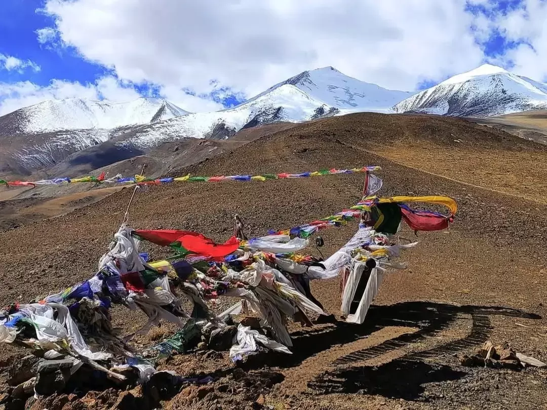
Thit Zarbo La Pass is a formidable high-altitude crossing situated at approximately 17,103 feet, primarily used by seasoned overlanders as a remote shortcut between Nyoma and Hanle. It serves as a vital gateway for those exploring the deep interior of the Changthang plateau, providing a rugged transit route that bypasses the traditional Loma bridge crossing and leads directly into the secluded lake country of the southeast.
The atmosphere on the pass is one of profound isolation, characterized by vast, windswept plains and a complete absence of permanent settlements or commercial infrastructure. Visitors experience a raw, unshielded connection to the elements, where the silent, brown mountain ridges contrast sharply with the brilliant turquoise waters of the nearby Kyun Tso (Chilling Tso and Ryul Tso) twin lakes, creating a surreal landscape that feels untouched by modern tourism.
What makes Thit Zarbo La distinct is its technical off-road character and its role as a strategic link to the world’s highest motorable pass, Umling La. It offers a rare opportunity for adventure travelers to navigate unpaved, sandy tracks and steep gravel inclines that are largely unknown to the general public, making it a premier destination for those seeking a true frontier experience in one of the most quiet and environmentally sensitive sectors of the Indo-China borderlands.
Thit Zarbo La is a high-altitude mountain pass situated at an elevation of approximately 5,416 meters (17,769 feet) in the Ladakh region. Located in the remote eastern sector of the Trans-Himalayas, it serves as an essential link between the Yaye Tso area and the Chushul valley, providing a rugged transit route through the high-plateau desert.
Geographically, the pass is characterized by its extreme isolation and sharp, winding gradients that navigate the mountain ridges of the Changthang. It acts as a natural drainage divide and offers a panoramic vantage point over the stark, arid landscape that defines the borderlands between the Indus Valley and the Pangong range. The terrain at the summit is dominated by permafrost and scree slopes, reflecting the harsh environmental conditions of the high-altitude steppe.
Historically, Thit Zarbo La has been utilized by the nomadic Changpa communities for the seasonal movement of pashmina goats, connecting disparate grazing grounds in the deep interior of Ladakh. In contemporary times, the pass holds significant strategic value due to its proximity to the Line of Actual Control (LAC). It is primarily used by the Border Roads Organization (BRO) and security forces for regional logistics. Because of its sensitive location and extreme altitude, access for tourists is strictly regulated and requires specific Inner Line Permits (ILP).
Thit Zarbo La, a high-altitude pass situated at approximately 16,000 feet near the Nubra Valley, is a remote crossing that is only accessible during the core Himalayan summer. Due to its status as a lesser-traversed route compared to Khardung La, snow clearance is less frequent, making the seasonal window for a safe crossing exceptionally narrow.
Thit Zarbo La Pass is a remote and high-altitude mountain pass located at approximately 5,420m (17,782 ft) in the Changthang region of Ladakh. It serves as a rugged link on the internal routes between the Mahe sector and the high-altitude plateaus near the Indus River, offering a true off-the-beaten-path experience for adventure travelers.
Thit Zarbo La is a high-altitude mountain pass located in the remote regions of Ladakh, often used as a challenging trekking or off-road link between the Indus and Nubra sectors. Its photography profile is defined by its extreme isolation and the raw, unpolished beauty of the Ladakh Range's interior, offering vistas that are rarely captured by mainstream travelers.
 Mountain Pass
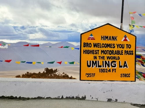
Umling La is a high-altitude mountain pass in the Eastern Ladakh region, situated at an elevation of 5,798 meters (19,024 feet) according to Guinness World Records.
 Mountain Pass
Photi La is a high-altitude mountain pass in the Leh district that serves as a remote gateway to the Hanle region of eastern Ladakh.
 Mountain Pass
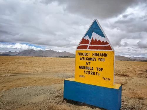
Nurbu La is a high-altitude mountain pass in Ladakh that connects Hanle to Umling La, offering scenic high-mountain views.
Get customized Ladakh tour planning designed around altitude comfort, acclimatization time, weather windows, and real Himalayan road conditions. Whether you are visiting for high mountain passes, monasteries, lakes, or remote valley experiences, our exper
⚡ Quick Response | 💰 Free consultation | 🕒 24×7 expert support

