+91 9910402252
admin@chalbanjare.com
| Entry Fee | Free |
| Timings | 06:00 - 17:00 |
| Altitude (m) | 1980 |
| Ideal Visit Duration (hrs) | 4 |
| Best Time of Day | Morning |
| Crowd Level | Moderate |
| Distance from City Centre (km) | 0 |
| Walking Difficulty | Easy |
| Parking Available | Yes |
| Last Mile Access | Road |
| Suitable for Kids | Yes |
| Suitable for Seniors | Yes |
| Wheelchair Friendly | No |
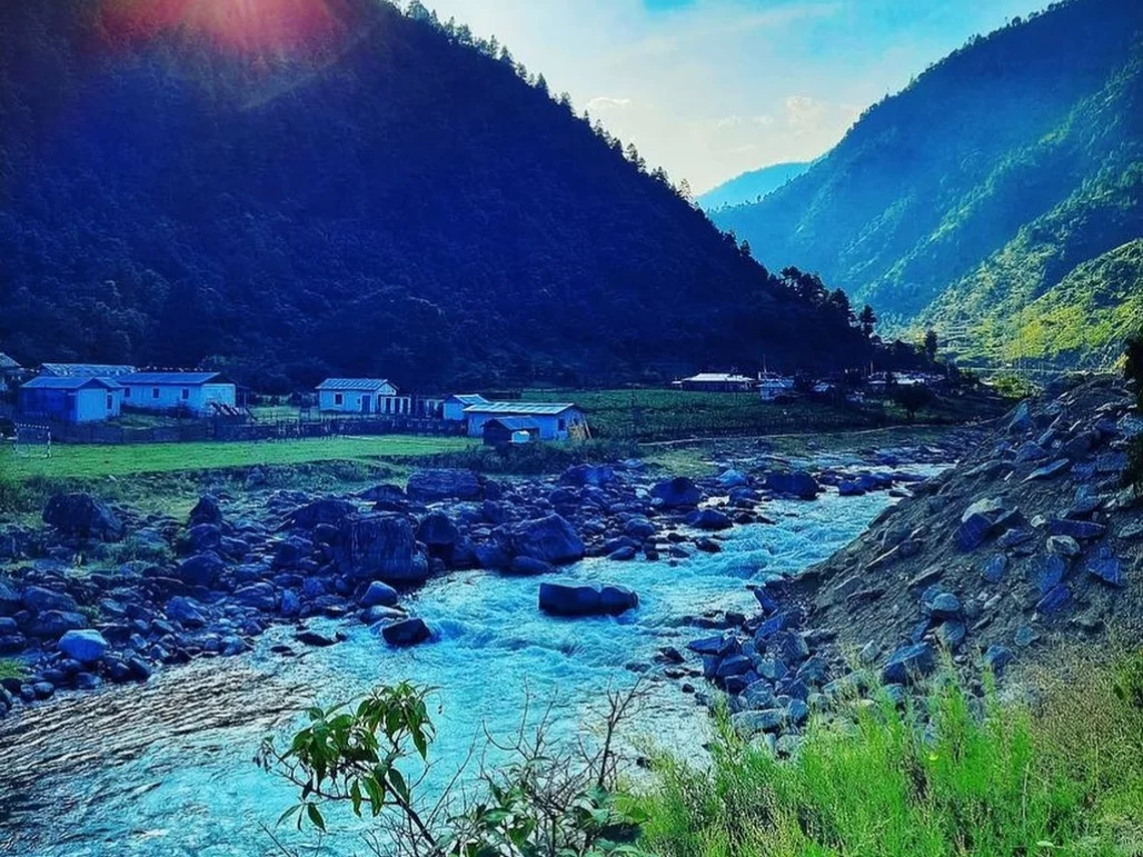
Tenga Valley serves as a critical mountain stopover for travelers ascending the steep ridges between Bhalukpong and Bomdila. Visitors are drawn to the valley’s unique microclimate, which is notably milder than the surrounding peaks, and its role as a strategic high-altitude military station that provides a rare look at the logistics and life of the Indian Army in the Eastern Himalayas.
The on-ground atmosphere is defined by an unusual blend of disciplined order and alpine tranquility. The valley floor is characterized by the sparkling Tenga River, neatly maintained military cantonments, and terraced agricultural plots where the air is crisp and scented with pine; the environment feels secure and sheltered, offering a sense of "civilization" in the midst of the rugged, untamed wilderness of West Kameng.
What makes Tenga Valley distinct is its accessibility to the Eagle’s Nest Wildlife Sanctuary, a world-renowned birding hotspot located just a short drive away. While the valley itself offers a comfortable rest point with its local markets and riverside views, its true value for travelers lies in its position as a launchpad for spotting rare species like the Bugun Liocichla, making it a vital hub for serious naturalists and ornithologists.
Tenga Valley is a high-altitude valley situated in the West Kameng district, carved by the Tenga River as it flows through the Eastern Himalayan ranges. Historically, the valley gained significant prominence following the 1962 Sino-Indian War, evolving into a vital strategic hub and a major military station for the Indian Army. This military presence has shaped the valley's modern infrastructure and contributed to the unique coexistence of a disciplined cantonment environment alongside the traditional ancestral lands of the Shertukpen and Monpa communities.
The cultural landscape is defined by its role as a transitional zone between the tropical foothills of Bhalukpong and the high-alpine reaches of Bomdila and Tawang. The valley is characterized by its distinctive microclimate and temperate vegetation, which differs sharply from the surrounding ridges. For visitors, the experience of Tenga Valley is marked by its serene river views and its function as a critical rest point on the historic trade and pilgrimage routes. The area reflects a blend of local tribal customs and a strong sense of national history, evidenced by the memorials and meticulously maintained landscapes that honor the region's geopolitical importance.
Tenga Valley, a strategic and scenic high-altitude bowl in West Kameng, is best experienced when the crisp mountain air ensures clear views of the surrounding ridges and the local orchards are in transition. Unlike the higher passes of Tawang, Tenga remains accessible through most of the winter, making it a reliable stop for those seeking a temperate mountain climate without the extreme sub-zero isolation of the higher reaches.
Tenga Valley, located in the West Kameng district of Arunachal Pradesh, is a strategically significant and scenic high-altitude valley. It serves as a major transit point between the plains of Assam and the higher reaches of Bomdila and Tawang.
Traveler Tip: Tenga Market is a reliable stop for refueling and basic supplies, as it hosts one of the last major petrol pumps before the climb to Bomdila. Note that accommodation options in the valley are limited compared to nearby Bomdila, so most travelers visit Tenga as a mid-journey stopover.
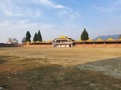 Tourist Attraction
Buddha Stadium is a public sports stadium located in Bomdila, West Kameng district, Arunachal Pradesh, India.
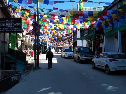 Market / Bazaar
Bomdila Market is the main local market of Bomdila where daily life, regional produce, and small-town trade come together.
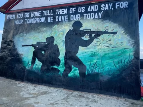 War Memorial
Bomdila War Memorial is a quiet hilltop memorial honoring Indian soldiers who lost their lives in the 1962 Sino-Indian War.
Get customized Arunachal Pradesh tour planning designed around mountain road distances, permit requirements, seasonal weather windows, and realistic travel pacing. Whether you are visiting for monasteries, high-altitude passes, river valleys, tribal cultu
⚡ Quick Response | 💰 Free consultation | 🕒 24×7 expert support

