Quick Facts About Gun Hill
| Entry Fee | Free |
| Timings | 10:00 - 18:00 |
| Altitude (m) | 2024 |
| Ideal Visit Duration (hrs) | 1 |
| Best Time of Day | Evening |
| Crowd Level | High |
| Distance from Mussoorie (km) | 1 |
| Walking Difficulty | Moderate |
| Parking Available | No |
| Last Mile Access | Road |
| Suitable for Kids | Yes |
| Suitable for Seniors | Yes |
| Wheelchair Friendly | No |
Why Visit Gun Hill, Mussoorie
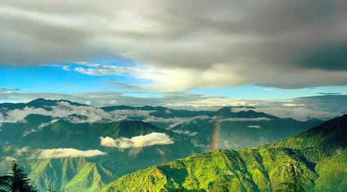
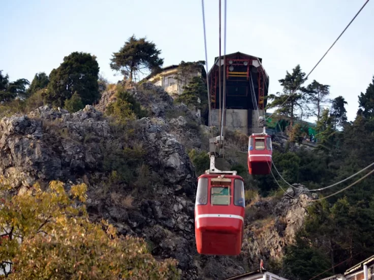
Gun Hill is one of the main viewpoints in Mussoorie, drawing visitors for its elevated position above Mall Road and its clear views of the surrounding Himalayan ranges and Doon Valley. Many travelers reach it via the short ropeway ride from Jhula Ghar or by a steep uphill walk, making it a central stop in a Mussoorie itinerary.
The atmosphere at Gun Hill is lively, especially during peak tourist seasons, with small stalls, viewing platforms, and steady footfall throughout the day. The summit area is compact and structured, offering defined viewing edges where visitors gather to take photos and observe the changing light over the mountains.
What makes Gun Hill distinct is its accessibility and its status as the second-highest peak in Mussoorie. Unlike remote viewpoints that require long drives, this spot combines a quick ropeway experience with wide valley and mountain views, making it convenient for travelers who want panoramic scenery within the town’s core area.
History of Gun Hill, Mussoorie
Gun Hill is the second-highest peak in Mussoorie, located in Dehradun district, Uttarakhand. During the British colonial period in the 19th century, it served as a significant vantage point overlooking the Doon Valley and the surrounding Himalayan ranges. Its elevated position made it both a recreational lookout and a practical signaling spot.
The hill derives its name from a cannon that was reportedly fired daily at midday to help residents set their clocks accurately, at a time when personal timekeeping devices were uncommon. This practice established Gun Hill as an important reference point in Mussoorie’s early settlement years.
Over time, Gun Hill evolved from a functional signaling location into a popular tourist viewpoint. While modern ropeway access has changed how visitors reach the summit, its historical identity remains tied to Mussoorie’s colonial-era infrastructure and daily life practices.
Best Time to Visit – Gun Hill, Mussoorie
Gun Hill in Mussoorie is most rewarding when Himalayan views are clear and skies are stable, as this elevated viewpoint depends on low haze and good visibility for distant snow-peak sightings and Doon Valley panoramas.
- Ideal months: March to June and October to November offer the clearest mountain views and pleasant weather.
- Weather during the best season: Spring and early summer bring mild temperatures (around 10–25°C) with relatively clear mornings, making it easier to spot Himalayan peaks such as Bandarpoonch on bright days. Post-monsoon autumn provides crisp air, greener slopes, and improved long-range visibility.
- Periods to avoid (and why): July to September brings heavy monsoon rainfall in Mussoorie, often causing dense fog that blocks peak views and reduces cable car visibility. Late December to January can be very cold with frequent cloud cover or fog, limiting panoramic clarity.
How to Reach Gun Hill Mussoorie
- Nearest Airport: Jolly Grant Airport, Dehradun (approximately 55–60 km from Mussoorie). From the airport, taxis to Mussoorie take around 1.5–2 hours depending on traffic and hill road conditions.
- Nearest Railway Station: Dehradun Railway Station (around 34 km away) is the nearest major railhead with regular train connectivity from Delhi and other major cities. Taxis and shared cabs from the station to Mussoorie are easily available, with the uphill journey taking about 1.5–2 hours.
- Road Access & Last-Mile Connectivity: Gun Hill is located above Mall Road near Library Chowk. It is primarily accessed via the Gun Hill Ropeway starting from Jhula Ghar (near Mall Road), with a short cable car ride of a few minutes. Visitors can also reach the top by a steep uphill walking trail from Mall Road, which takes approximately 20–30 minutes. During peak tourist seasons and weekends, ropeway queues can be long, and operations may be temporarily suspended during strong winds or heavy rain.
What to Expect When You Visit Gun Hill Mussoorie
- Environment and Surroundings: Gun Hill is the second-highest peak in Mussoorie, Uttarakhand, located near Mall Road and offering elevated views of the Doon Valley and surrounding Himalayan ranges on clear days. The summit area is developed with a viewing platform and open sections overlooking steep slopes. The surroundings are more commercial compared to quieter viewpoints. During monsoon (July to September), mist and cloud cover frequently reduce visibility.
- Facilities and Amenities: The top area includes small food stalls, souvenir shops, and basic amusement activities. Seating is limited and informal. Public toilet facilities may be available nearby but are simple in infrastructure. Waste bins are placed in the area, though cleanliness depends on crowd levels. The commercial nature of the site means noise levels can be higher than other viewpoints.
- Accessibility and Movement: Gun Hill is accessible either by a short uphill walk from Mall Road or by ropeway from near Jhula Ghar. The ropeway operates seasonally and may close during adverse weather conditions. The summit terrain is mostly paved but can become crowded and slightly uneven in parts. Movement is manageable for most visitors, though peak-hour congestion is common.
- Typical Visitor Behavior and Conditions: The site experiences high footfall throughout the day, especially during peak tourist seasons (April–June and October) and on weekends. Visitors typically spend 20–40 minutes at the summit for photography and short breaks. During foggy weather, views of the valley and distant peaks may be obscured, and waiting times for the ropeway can increase significantly during busy periods.
Important Visitor Information – Gun Hill Mussoorie
- Crowd & Weather Notes: Gun Hill is one of the busiest attractions in Mussoorie, especially during peak tourist seasons (April to June and October) and on weekends. Midday can be crowded due to ropeway visitors from Mall Road. In monsoon (July to September), visibility may be affected by fog, and surfaces around the viewpoint can become damp. Winters (December to February) are cold, with occasional frost in early mornings.
- Peak / Quiet Hours: The busiest hours are between 11:00 AM and 4:30 PM when ropeway traffic is highest. Early mornings, soon after opening, are comparatively less crowded. Late afternoons approaching sunset also attract visitors, weather permitting.
- Dress Code: No formal dress code applies. Comfortable footwear is recommended due to steps and uneven walking areas near the viewpoint. Warm clothing is advisable during winter and breezy evenings.
- Safety Notes: Follow ropeway safety instructions and queue guidelines during boarding. The summit area has steep edges in certain sections; visitors should stay within designated viewing zones. The area can become congested during peak hours, so supervision of children is essential. Food stalls operate at the top, but crowd movement may be restricted during busy periods.
Photography and Viewpoints – George Everest House Mussoorie
- Best viewpoints/angles: The open ridge behind the heritage structure offers panoramic views of the Doon Valley on one side and snow-clad Himalayan ranges (including Bandarpoonch and Swargarohini peaks on clear days) on the other; position slightly downhill from the building to frame the stone façade against the sky; the cliff-edge meadow areas provide dramatic valley-drop compositions, especially at sunset.
- Lighting & time-of-day: Early morning provides the clearest Himalayan visibility before haze builds up over the plains; late afternoon into sunset enhances ridge contours and creates strong silhouettes against the valley; during monsoon, cloud movement adds atmosphere but long-distance mountain visibility may be limited.
- Rules/restrictions: Photography is allowed in the open grounds and around the structure; interior access may be restricted depending on conservation status; crossing safety barriers near cliff edges is unsafe and not permitted; drone use may require local administrative permission and is subject to regulation.
- Crowd & access factors: The site is popular during weekends and sunset hours, limiting uninterrupted ridge compositions; early weekday visits provide clearer frames; the final approach road and walking stretch can be uneven and dusty in dry months, and slippery during monsoon, affecting stable equipment placement.