+91 9910402252
admin@chalbanjare.com
| Entry Fee | No entry fee to visit the region; individual attractions within the Khasi Hills may have separate charges. |
| Timings | Accessible throughout the day; timings depend on the specific attraction being visited. |
| Altitude (m) | Approximately 1,500 m average elevation; varies significantly across the region. |
| Ideal Visit Duration | 2–5 days |
| Best Time of Day | Morning for clear views before clouds and mist become more prominent. |
| Crowd Level | Moderate; major destinations such as Shillong, Sohra, and Dawki attract higher visitor numbers. |
| Distance from City Centre (km) | Approximately 0 km from Shillong, which is located within the Khasi Hills region. |
| Walking Difficulty | Varies from Easy to Challenging depending on the chosen attraction, trek, or viewpoint. |
| Parking Available | Available at most major tourist attractions and viewpoints; availability varies by location. |
| Last Mile Access | Most major attractions are accessible by road, though some waterfalls, caves, and living root bridges require walking or trekking. |
| Suitable for Kids | Yes; suitability depends on the specific attraction and activity. |
| Suitable for Seniors | Yes; many viewpoints and attractions are easily accessible, though some trekking sites may be challenging. |
| Wheelchair Friendly | Varies by attraction; some viewpoints are accessible, while caves, waterfalls, and trekking routes are generally not. |
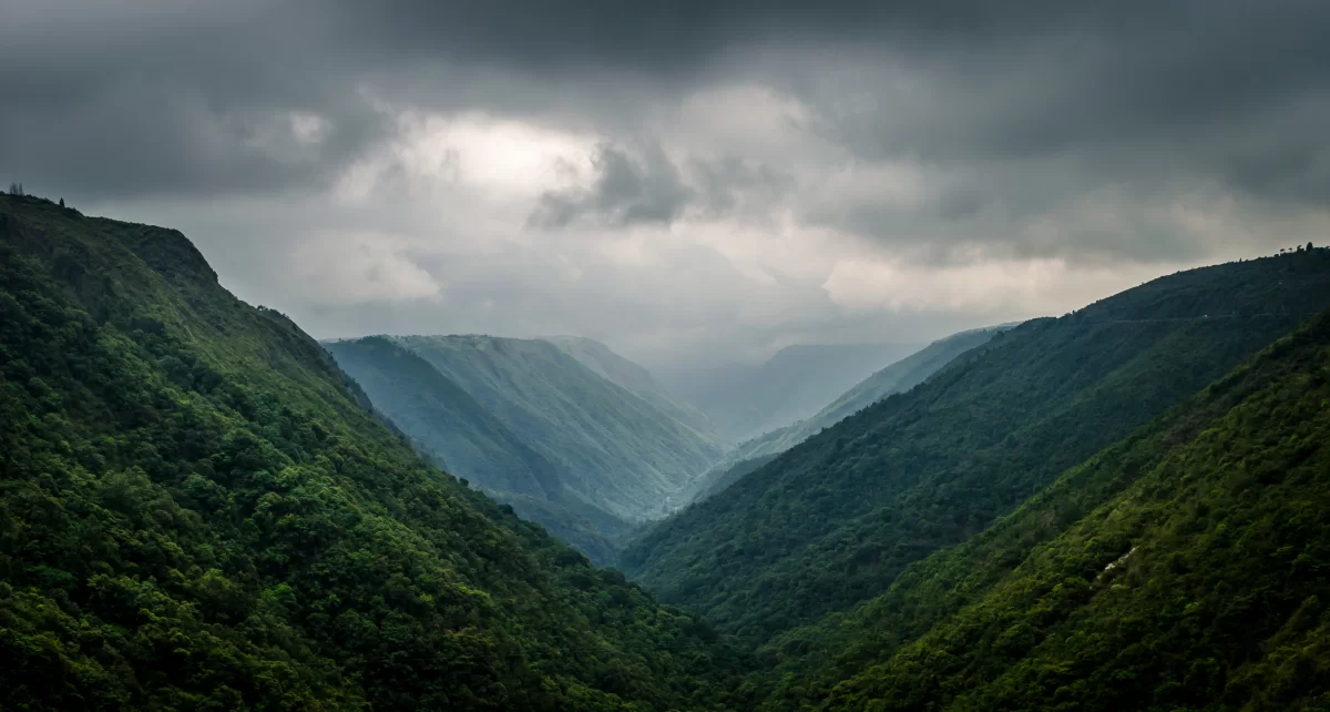
Visitors come to the Khasi Hills for their rolling landscapes, waterfalls, forest trails, and the opportunity to experience the natural and cultural character of Meghalaya’s highlands.
The atmosphere is refreshing and scenic, with mist-covered valleys, traditional Khasi settlements, and changing weather conditions that create distinctive mountain views throughout the year.
What makes the Khasi Hills distinct is the combination of dramatic limestone landscapes, sacred forests, living root bridges, and a strong indigenous heritage that shapes the region’s identity and visitor experience.
The Khasi Hills form a historically significant region of Meghalaya and have been home to the Khasi people for centuries. Governed through a traditional system of indigenous chieftainships known as Hima, the region developed a distinct cultural identity shaped by its unique social customs, community institutions, and close relationship with the natural environment.
During the 19th century, the Khasi Hills became an important area of interaction between the Khasi states and the British administration. The region played a notable role in the Anglo-Khasi conflicts, particularly under the leadership of U Tirot Sing, who is remembered for resisting British expansion into Khasi territory.
Today, the Khasi Hills remain an important cultural landscape of northeastern India, preserving the traditions, heritage, and indigenous identity of the Khasi community while attracting visitors with their scenic valleys, forests, waterfalls, and living cultural heritage.
Khasi Hills is best visited from October to April when the weather is pleasant, visibility is excellent, and visitors can comfortably explore waterfalls, viewpoints, caves, forests, and traditional Khasi villages across the region.
 Hot Spring
Jakrem Hot Spring is a natural thermal spring located near Mawsynram in East Khasi Hills district, Meghalaya, India.
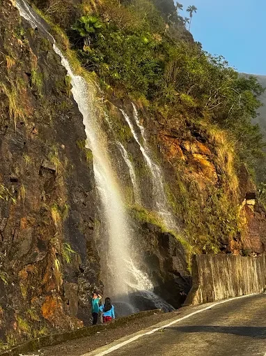 Waterfall
Khreng Khreng Falls is a natural waterfall located in the state of Meghalaya, India.
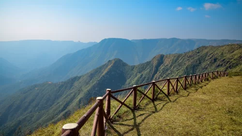 Viewpoint
Laitlum Canyon is a scenic canyon and viewpoint located in East Khasi Hills district, Meghalaya, known for its dramatic cliffs, deep valleys, and panoramic views of the surrounding landscape.
Get customized Meghalaya tour planning designed around rainfall patterns, road connectivity, seasonal visibility, and realistic hill travel timing. Whether you are visiting for waterfalls, cave exploration, scenic drives, village experiences, or nature-fo
⚡ Quick Response | 💰 Free consultation | 🕒 24×7 expert support

