+91 9910402252
admin@chalbanjare.com
| Entry Fee | Free |
| Timings | 24 Hours (Seasonal) |
| Altitude (m) | 3490 |
| Ideal Visit Duration (mins) | 45 |
| Best Time of Day | Midday |
| Crowd Level | Moderate |
| Distance from Shopian (km) | 40 |
| Distance from Srinagar (km) | 95 |
| Distance from Poonch (km) | 55 |
| Walking Difficulty | Easy |
| Parking Available | Yes |
| Last Mile Access | Road |
| Suitable for Kids | Yes |
| Suitable for Seniors | Yes |
| Wheelchair Friendly | Partial |
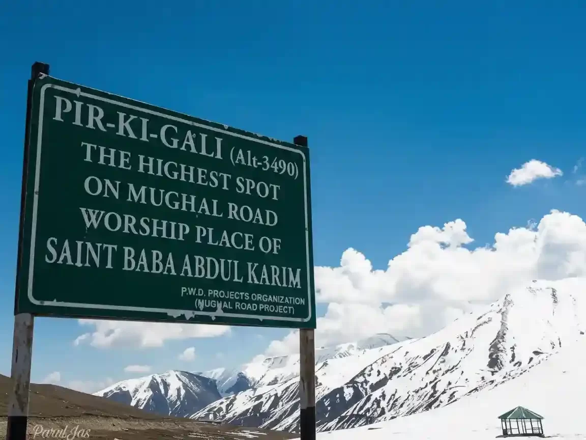
Pir Ki Gali serves as the highest point and the spiritual heart of the historic Mughal Road, situated at an elevation of 11,450 feet. Travelers visit this mountain pass to traverse the ancient imperial route that connects the Poonch and Rajouri districts with the Kashmir Valley, offering a scenic alternative to the traditional Jammu-Srinagar highway while providing a gateway to the high-altitude alpine lakes of the Pir Panjal range.
The atmosphere on the ground is defined by vast, rolling green meadows and the cool, mist-laden winds that frequently sweep across the ridge. Visitors experience a unique blend of natural beauty and spiritual serenity at the shrine of the 17th-century saint, Sheikh Ahmad Karim, where the silence of the mountains is complemented by the presence of nomadic Gujjar and Bakarwal tribes moving their herds through the verdant pastures during the summer months.
What makes Pir Ki Gali distinct is its role as a dramatic climatic and topographical divide between the subtropical Jammu hills and the temperate Kashmir highlands. It offers a rare vantage point to view the snow-capped peaks of the Pir Panjal mountains alongside the historical remains of Mughal-era inns (sarais), making it a premier destination for those interested in the intersection of medieval history, nomadic culture, and pristine Himalayan landscapes.
Pir Ki Gali is a high-altitude mountain pass situated at an elevation of 3,485 meters (11,433 feet) in the Pir Panjal Range. It serves as the highest point on the historic Mughal Road, connecting the Shopian district of the Kashmir Valley with the Poonch and Rajouri districts of the Jammu region.
Geographically, the pass acts as a natural gateway and a climatic divide between the lush Kashmir Valley and the rugged hilly terrain of Jammu. It is surrounded by alpine meadows, known as marg-s, and snow-capped peaks that remain white for a large part of the year. The pass is a critical landmark for the nomadic Bakarwal and Gujjar tribes who traverse this route during their seasonal migration with livestock between the high pastures and the plains.
Historically, Pir Ki Gali has been an integral part of the ancient Imperial Road used by Mughal Emperors like Akbar, Jahangir, and Shah Jahan to travel to Kashmir. The pass is named after a local Sufi saint, Sheikh Ahmed Karim, popularly known as Peer Baba, whose shrine (Dargah) is located at the summit and is revered by travelers of all faiths. Today, it is a major stop for tourists and locals alike, maintained by the Public Works Department to ensure connectivity through the majestic Pir Panjal mountains during the summer and autumn months.
Pir Ki Gali, the highest point of the historic Mughal Road at 11,450 feet, serves as the scenic gateway between the Shopian and Poonch-Rajouri districts. Unlike the all-weather NH44, this pass is a seasonal high-altitude crossing that remains buried under several feet of snow for half the year, making timing essential for those wishing to experience its alpine meadows and the Sufi shrine of Sheikh Ahmed Karim.
Pir Ki Gali, situated at an elevation of approximately 3,485m (11,433 ft), is the highest point and the heart of the historic Mughal Road. It serves as a scenic mountain pass connecting the Shopian district of the Kashmir Valley with the Poonch and Rajouri districts of the Jammu region, offering a high-altitude alternative to the traditional Jammu-Srinagar National Highway (NH44).
 Temple
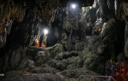
Nau Devi Cave Temple is a Hindu cave shrine located in Reasi district of Jammu & Kashmir, India.
 Fort
Fort
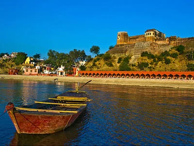
Akhnoor Fort is a historic fort located on the banks of the Chenab River in Akhnoor, Jammu, Jammu and Kashmir, built during the Dogra period over earlier archaeological remains.
 Pilgrimage Site
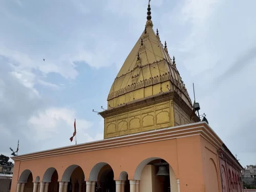
A historic Hindu temple dedicated to Lord Shiva, located in the Niranjani Akhara area of Jammu.
Get customized Jammu and Kashmir tour planning designed around seasonal weather patterns, valley travel routes, snow conditions, and realistic hill road timing. Whether you are visiting for scenic landscapes, serene lakes, spiritual journeys, meadow stays
⚡ Quick Response | 💰 Free consultation | 🕒 24×7 expert support

