+91 9910402252
admin@chalbanjare.com
| Entry Fee | Free |
| Timings | 00:00 - 23:59 |
| Altitude (m) | 195 |
| Ideal Visit Duration (hrs) | 3 |
| Best Time of Day | Morning |
| Crowd Level | Moderate |
| Distance from City Centre (km) | 30 |
| Walking Difficulty | Moderate |
| Parking Available | No |
| Last Mile Access | Walk |
| Suitable for Kids | Yes |
| Suitable for Seniors | No |
| Wheelchair Friendly | No |
Visitors come to the Siyom River for its wide river valleys, clear mountain water, and opportunities for riverside exploration across districts like Mechuka and Aalo. It attracts travelers interested in angling, rafting in select stretches, and experiencing remote Himalayan river landscapes without heavy tourist infrastructure.
On the ground, the river feels expansive and untamed, with gravel banks, cold fast-moving currents, and forested slopes rising on both sides. Depending on the season, water levels vary significantly, and local villages along the banks maintain a quiet, rural rhythm.
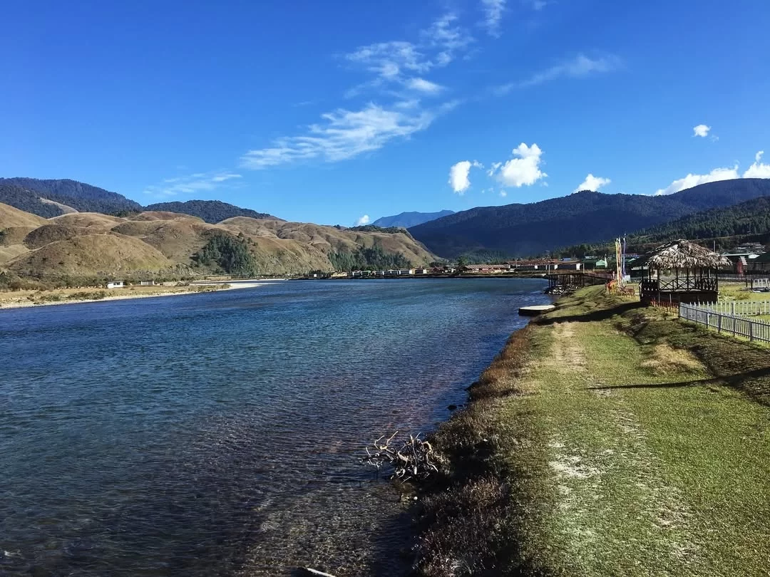
What makes the Siyom River distinct is its role as a major tributary of the Brahmaputra flowing through sparsely populated terrain. Unlike urban riverfronts, it remains largely natural, offering travelers a raw, high-altitude river environment shaped by monsoon flow and Himalayan geography.
Visitors come to the Siyom River for its wide river valleys, clear mountain water, and opportunities for riverside exploration across districts like Mechuka and Aalo. It attracts travelers interested in angling, rafting in select stretches, and experiencing remote Himalayan river landscapes without heavy tourist infrastructure.
On the ground, the river feels expansive and untamed, with gravel banks, cold fast-moving currents, and forested slopes rising on both sides. Depending on the season, water levels vary significantly, and local villages along the banks maintain a quiet, rural rhythm.
What makes the Siyom River distinct is its role as a major tributary of the Brahmaputra flowing through sparsely populated terrain. Unlike urban riverfronts, it remains largely natural, offering travelers a raw, high-altitude river environment shaped by monsoon flow and Himalayan geography.
The Siyom River flows through Mechuka in Shi-Yomi district, Arunachal Pradesh, forming the central geographical feature of the valley. Originating in the higher Himalayan ranges near the Indo-China border, the river runs southward through steep mountain terrain before eventually joining the Siang River system.
In Mechuka, the river is characterized by a wide, stony riverbed, clear cold water, and surrounding alpine and subalpine landscapes. Seasonal variations significantly affect water volume, with stronger flow during the monsoon months and comparatively calmer stretches in winter.
The Siyom River supports local agriculture and settlement patterns in the valley and serves as a natural landmark for travelers exploring Mechuka. Its open riverbanks and suspension bridges provide accessible viewpoints without formal commercial infrastructure along most stretches within the town limits.
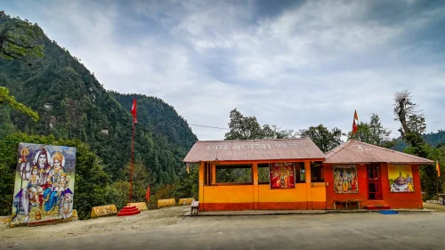 Temple
Sri Hanuman Temple is a Hindu temple located in Mechuka, Shi Yomi district, Arunachal Pradesh, India.
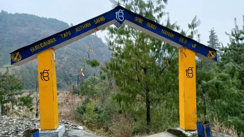 Gurudwara
Gurudwara Mechuka Sahib is a Sikh shrine located in Mechuka Valley of Shi Yomi district, Arunachal Pradesh, India.
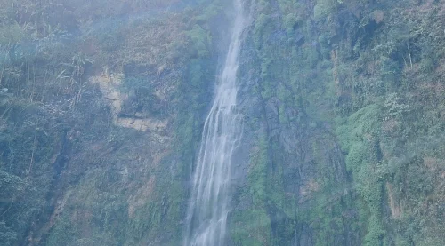 Waterfall
Siko Dido Waterfalls is a natural waterfall located near Mechuka in Shi Yomi district, Arunachal Pradesh, India.
Get customized Arunachal Pradesh tour planning designed around mountain road distances, permit requirements, seasonal weather windows, and realistic travel pacing. Whether you are visiting for monasteries, high-altitude passes, river valleys, tribal cultu
⚡ Quick Response | 💰 Free consultation | 🕒 24×7 expert support

