+91 9910402252
admin@chalbanjare.com
| Entry Fee | No entry fee |
| Timings | Accessible during daylight hours; sunrise to sunset visits are recommended. |
| Altitude (m) | Approximately 1,830 m above sea level |
| Ideal Visit Duration | 1–2 hours |
| Best Time of Day | Morning for clearer views and favorable photography conditions |
| Crowd Level | Moderate; visited by most travelers on the Tawang–Jang route |
| Distance from City Centre (km) | Approximately 40 km from Tawang town centre |
| Walking Difficulty | Easy to Moderate; involves short walks and some steps to reach viewing areas |
| Parking Available | Yes, parking facilities are available near the waterfall viewpoint |
| Last Mile Access | Direct road access via Jang Falls Road followed by a short walk to the viewing platform |
| Suitable for Kids | Yes, with supervision near wet rocks and viewing edges |
| Suitable for Seniors | Yes, though some viewpoints may require walking on uneven surfaces |
| Wheelchair Friendly | Partially; the main viewing area is accessible, but access to lower viewpoints may be limited |
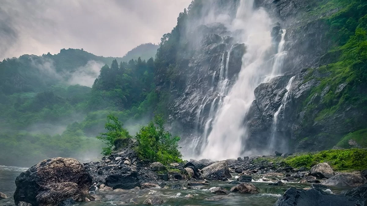
Visitors come to Nuranang Waterfall to witness one of Arunachal Pradesh’s most impressive cascades, where water plunges down a steep mountainside amidst dense Himalayan scenery.
The atmosphere is refreshing and scenic, with misty surroundings, the sound of rushing water, and forested landscapes creating an immersive natural experience.
What makes Nuranang Waterfall distinct is its powerful drop, year-round flow fed by mountain streams, and its picturesque location near Tawang, making it one of the region’s most photographed natural attractions.
Nuranang Waterfall, located near Jang in Arunachal Pradesh, is one of the most prominent natural landmarks in the Tawang region. While the waterfall itself is a natural feature formed by the Nuranang River, its name is closely associated with local accounts from the 1962 Sino-Indian War.
According to regional tradition, the waterfall is believed to be named after a local Monpa girl named Nura, who is said to have assisted Indian soldiers during the conflict. Although the story is rooted in local folklore and wartime narratives, it has become an enduring part of the area's cultural identity.
Today, Nuranang Waterfall is valued for both its scenic beauty and its connection to the historical memory of the Tawang region, attracting visitors interested in the natural landscapes and heritage of Arunachal Pradesh.
Nuranang Waterfall is best visited from March to June and September to November when the weather in the Tawang region is pleasant, visibility is clear, and travel conditions are generally favorable for sightseeing and photography.
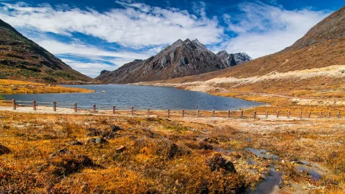 Lake
Lake
Sela Lake is a high-altitude glacial lake located near Sela Pass in Tawang district, Arunachal Pradesh, India.
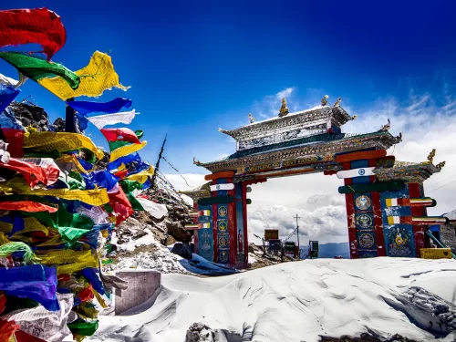 Tourist Attraction
Sela Pass is a high-altitude mountain pass located in Tawang district, Arunachal Pradesh, India.
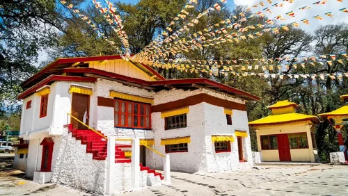 Monastery
Ugyenling Buddhist Monastery is a Buddhist monastery located near Tawang in Arunachal Pradesh, India.
Get customized Arunachal Pradesh tour planning designed around mountain road distances, permit requirements, seasonal weather windows, and realistic travel pacing. Whether you are visiting for monasteries, high-altitude passes, river valleys, tribal cultu
⚡ Quick Response | 💰 Free consultation | 🕒 24×7 expert support

