+91 9910402252
admin@chalbanjare.com
| Entry Fee | Free |
| Timings | 06:00 - 17:30 |
| Altitude (m) | 210 |
| Ideal Visit Duration (hrs) | 4 |
| Best Time of Day | Morning |
| Crowd Level | Moderate |
| Distance from City Centre (km) | 2 |
| Walking Difficulty | Moderate |
| Parking Available | Yes |
| Last Mile Access | Road |
| Suitable for Kids | Yes |
| Suitable for Seniors | No |
| Wheelchair Friendly | No |
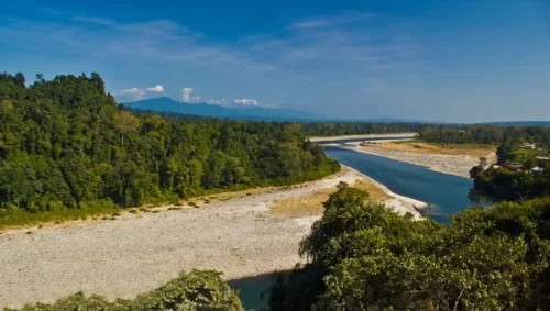
The Kameng River in Bhalukpong is the primary draw for adventure travelers seeking some of the most technical whitewater and rewarding sport fishing in Northeast India. Visitors come specifically to challenge the river’s Class III and IV rapids or to track the legendary Golden Mahseer, a prize catch for catch-and-release anglers that thrives in these cold, oxygenated Himalayan waters before they merge with the Brahmaputra.
The on-ground atmosphere is defined by the stark contrast between the roaring emerald currents and the vast, silent shingle beaches that line the riverbanks. The environment feels distinctly wild and primordial, characterized by the sight of traditional Aka fishermen navigating the rocky shores and the sound of the water echoing against the high, jungle-clad cliffs of the Pakhui Tiger Reserve that form the river's western boundary.
What makes this stretch of the Kameng distinct is its role as a natural border and a biodiversity corridor. Unlike other Himalayan rivers that are often inaccessible due to steep gorges, the riverfront at Bhalukpong offers wide, accessible spans that allow for multi-day rafting expeditions to conclude on sandy beaches, providing travelers a rare opportunity to see hornbills and other tropical wildlife directly from the water's edge.
The Kameng River, which originates from the glacial lakes below Mount Kangto, serves as the defining geographical feature of Bhalukpong and the natural border between the East and West Kameng districts. Historically known as the Bhareli River in the plains of Assam, it has functioned for centuries as a vital lifeline for the indigenous Aka (Hrusso) and Nyishi tribes. The river’s high-volume discharge and rugged canyon topography at Bhalukpong mark the dramatic transition where the Himalayan waters exit the steep mountain gorges and enter the Brahmaputra valley.
The riverfront is ecologically inseparable from the Pakhui (Pakke) Tiger Reserve, acting as a critical water source for the region's diverse megafauna and rare avian species like the Great Hornbill. Culturally, the Kameng is respected as a powerful natural entity in local folklore, influencing the settlement patterns and traditional fishing practices of the riverside communities. For visitors, the river provides a primary site for adventure-based tourism, specifically white-water rafting and angling, while offering a direct perspective on the untamed hydraulic forces that have shaped the landscape of the Arunachal foothills.
The Kameng River at Bhalukpong is a premier destination for white-water rafting and angling, but its character changes dramatically with the Himalayan snowmelt and monsoon cycles. To experience the river's famous emerald-clear waters and stable banks, visitors must time their trip to avoid the high-silt periods when the current becomes dangerously unpredictable and the surrounding foothills become prone to instability.
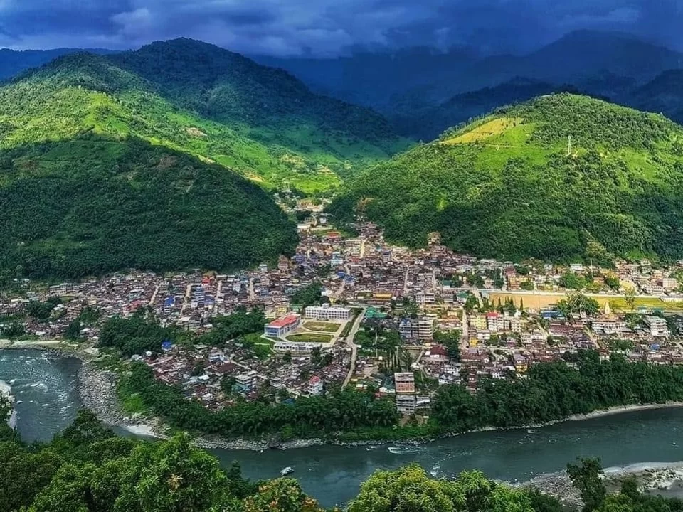
Bhalukpong, situated on the border of Assam and Arunachal Pradesh, is the primary entry point for the Tawang circuit. Accessing this town involves traveling through the plains of Upper Assam before entering the Himalayan foothills via a regulated check post.
 National Park
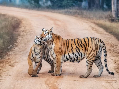
Pakke Tiger Reserve is a protected tiger reserve located in East Kameng district, Arunachal Pradesh, India.
 Waterfall
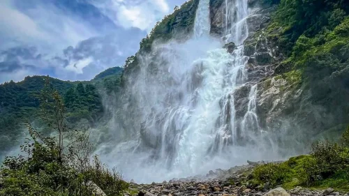
Navika Waterfall is a natural waterfall located near Bhalukpong in West Kameng district, Arunachal Pradesh, India.
 Viewpoint
Sessa View Point is a scenic viewpoint located near Sessa village in the Bhalukpong region of West Kameng district, Arunachal Pradesh, India.
Get customized Arunachal Pradesh tour planning designed around mountain road distances, permit requirements, seasonal weather windows, and realistic travel pacing. Whether you are visiting for monasteries, high-altitude passes, river valleys, tribal cultu
⚡ Quick Response | 💰 Free consultation | 🕒 24×7 expert support

