+91 9910402252
admin@chalbanjare.com
| Entry Fee | No entry fee; a special permit approved by the civil administration and Indian Army is mandatory for visitors. |
| Timings | Accessible during permitted daylight hours; visits are subject to weather, security regulations, and permit approvals. |
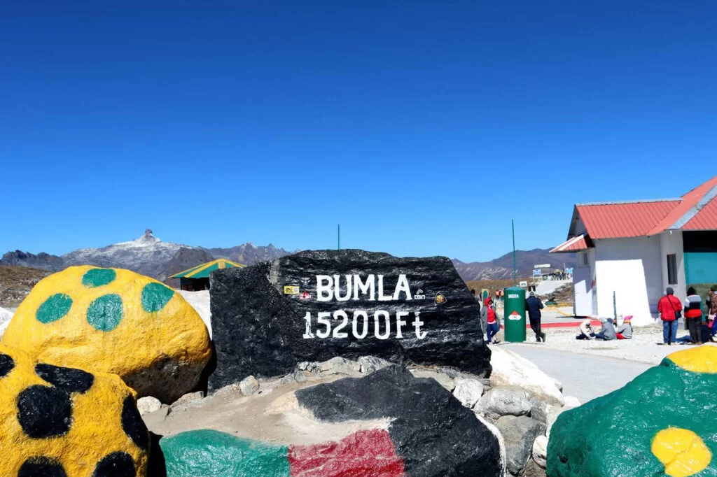
| Altitude (m) | Approximately 4,572 m (15,000–15,200 ft) above sea level |
| Ideal Visit Duration | 2–4 hours (excluding travel time from Tawang) |
| Best Time of Day | Morning for clearer weather and better chances of reaching the pass before cloud cover develops |
| Crowd Level | Moderate; visitor numbers are regulated through the permit system |
| Distance from City Centre (km) | Approximately 37 km from Tawang town centre |
| Walking Difficulty | Easy; sightseeing involves short walks, though the extreme altitude can make physical activity more demanding |
| Parking Available | Limited parking available near designated visitor areas |
| Last Mile Access | Accessible only via permitted local vehicles from Tawang; personal vehicles are generally not allowed beyond designated checkpoints |
| Suitable for Kids | Yes, but high-altitude conditions require extra caution and acclimatization |
| Suitable for Seniors | Yes, provided they are comfortable with high-altitude travel and have no serious health concerns |
| Wheelchair Friendly | Partially; some viewing areas are accessible, though terrain, weather, and military infrastructure may limit movement |
Visitors come to Bum La Pass to experience a high-altitude border destination, witness the dramatic Himalayan landscape, and explore one of the most significant mountain passes near Tawang.
The atmosphere is rugged and awe-inspiring, with alpine terrain, changing weather conditions, and panoramic views that highlight the remoteness of the eastern Himalayas.
What makes Bum La Pass distinct is its location on the India–China border, its historical significance, and the opportunity to visit one of the highest accessible mountain passes in Arunachal Pradesh with the required permits.
Bum La Pass is a historic mountain pass located at an altitude of over 4,600 meters on the India–China border near Tawang in Arunachal Pradesh. For centuries, the pass served as an important route connecting the Tawang region with Tibet, facilitating trade, travel, and cultural exchange across the eastern Himalayas.
The pass holds significant historical importance due to its role during the 1962 Sino-Indian War, when it became one of the key sectors of military engagement between India and China. Several nearby sites and memorials commemorate the bravery and sacrifices of Indian soldiers who defended the region during the conflict.
Today, Bum La Pass remains an important strategic border location and a notable destination for visitors exploring Tawang's military history, trans-Himalayan heritage, and high-altitude landscapes.
Bum La Pass is best visited from May to October when road conditions are generally more favorable and visitors have the highest likelihood of reaching this high-altitude Indo-China border pass without major weather-related disruptions.
 Lake
Lake
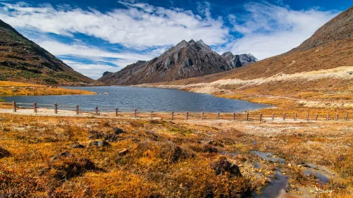
Sela Lake is a high-altitude glacial lake located near Sela Pass in Tawang district, Arunachal Pradesh, India.
 Tourist Attraction
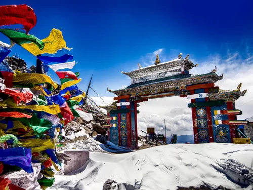
Sela Pass is a high-altitude mountain pass located in Tawang district, Arunachal Pradesh, India.
 Monastery
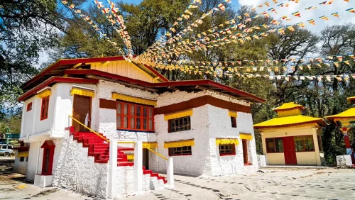
Ugyenling Buddhist Monastery is a Buddhist monastery located near Tawang in Arunachal Pradesh, India.
Get customized Arunachal Pradesh tour planning designed around mountain road distances, permit requirements, seasonal weather windows, and realistic travel pacing. Whether you are visiting for monasteries, high-altitude passes, river valleys, tribal cultu
⚡ Quick Response | 💰 Free consultation | 🕒 24×7 expert support

