+91 9910402252
admin@chalbanjare.com
| Entry Fee | Free |
| Timings | 00:00 - 23:59 |
| Altitude (m) | 213 |
| Ideal Visit Duration (hrs) | 24 |
| Best Time of Day | Morning |
| Crowd Level | Moderate |
| Distance from City Centre (km) | 0 |
| Walking Difficulty | Easy |
| Parking Available | Yes |
| Last Mile Access | Road |
| Suitable for Kids | Yes |
| Suitable for Seniors | Yes |
| Wheelchair Friendly | No |
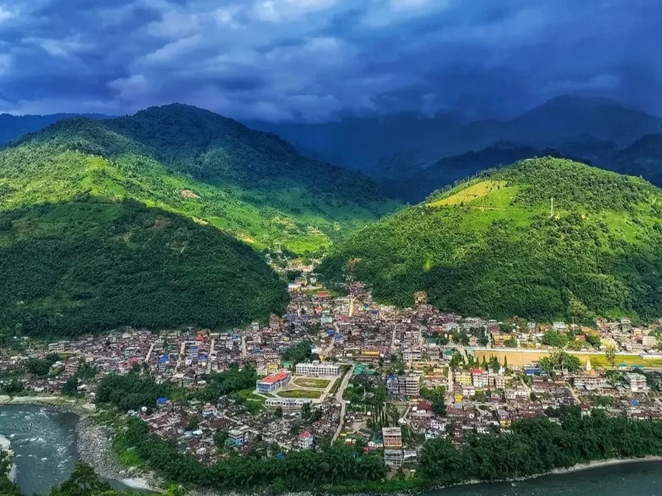
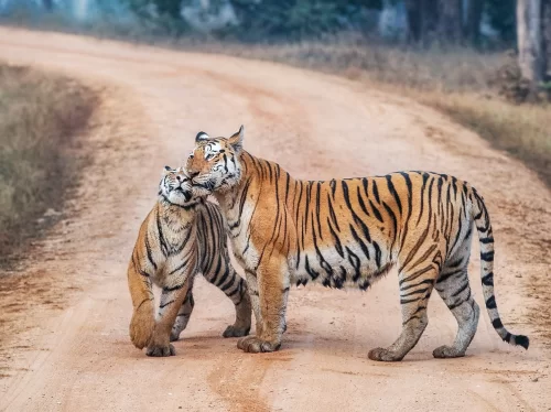
Bhalukpong serves as the essential entry point for travelers ascending from the Assam plains into the high-altitude landscapes of western Arunachal Pradesh. Most visitors arrive to navigate the transition between ecosystems, using the town as a base for river-side angling, whitewater rafting on the Kameng River, or as a gateway to the nearby Pakhui Tiger Reserve, where the biodiversity of the Himalayan foothills is most accessible.
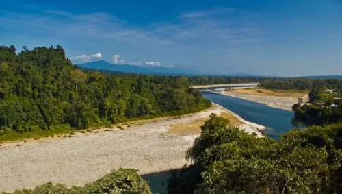
The on-ground atmosphere is defined by the constant presence of the Jia Bhoreli (Kameng) River, whose emerald waters and expansive shingle banks provide a rugged, outdoor-centric environment. Life here moves to the rhythm of the river and the inner-line permit gates; it is a frontier setting where the air cools significantly and the dense semi-evergreen forests begin to dominate the horizon, offering a quiet, transitionary pace before the steep climb toward Tawang.
What makes Bhalukpong distinct is its unique position as a cultural and ecological crossroads where the Aka (Hrusso) tribe’s heritage meets the wild landscapes of the border. It is one of the few places in the region where travelers can experience world-class mahseer fishing in a pristine river environment while being minutes away from archaeological remains at Bhalukpong Fort, providing a rare blend of active adventure and ancient Himalayan history.
Bhalukpong is situated along the banks of the Kameng River (historically known as the Jia Bhoreli) at the foothills of the Himalayas, serving as the traditional gateway to the Tawang and Bomdila circuits of West Kameng. The town’s identity is rooted in its historical role as a strategic buffer and trade point between the plains of Assam and the highlands of Arunachal Pradesh. It is home to the Aka (Hrusso) tribe, whose cultural heritage is characterized by a deep-rooted connection to the surrounding forests and a history of self-governance through the "Klowzene" council system.
The cultural landscape of Bhalukpong is inextricably linked to the Pakhui (Pakke) Tiger Reserve and the ecological transition from the floodplains to the montane forests. Historically, the area is associated with the remnants of a 10th-century fort, believed by local tradition to be the capital of King Bhaluka, the grandson of King Bana. For the traveler, the town represents a critical junction of biodiversity and heritage, where the annual Nyethidow festival of the Aka people highlights the community's spiritual rituals, traditional dances, and the preservation of indigenous customs in a modernizing transit hub.
Bhalukpong serves as the primary entry point for the Kameng circuit, and its suitability is dictated by its position at the edge of the Himalayan foothills where the Kameng River emerges into the plains. While the town remains open year-round, its true appeal as a hub for angling and rafting is strictly seasonal, tied to the water clarity of the river and the passability of the steep mountain roads leading toward Tawang.
Bhalukpong, located on the border of Assam and the West Kameng district of Arunachal Pradesh, serves as the primary gateway for the Tawang circuit. Situated along the banks of the Kameng River, it is the logistical hub where travelers transition from the plains into the Himalayan foothills.
 National Park
Pakke Tiger Reserve is a protected tiger reserve located in East Kameng district, Arunachal Pradesh, India.
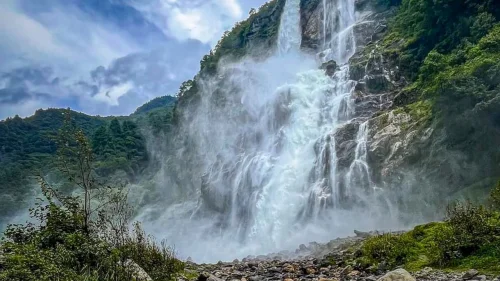 Waterfall
Navika Waterfall is a natural waterfall located near Bhalukpong in West Kameng district, Arunachal Pradesh, India.
 Viewpoint
Sessa View Point is a scenic viewpoint located near Sessa village in the Bhalukpong region of West Kameng district, Arunachal Pradesh, India.
Get customized Arunachal Pradesh tour planning designed around mountain road distances, permit requirements, seasonal weather windows, and realistic travel pacing. Whether you are visiting for monasteries, high-altitude passes, river valleys, tribal cultu
⚡ Quick Response | 💰 Free consultation | 🕒 24×7 expert support

