+91 9910402252
admin@chalbanjare.com
| Entry Fee | Free |
| Timings | 08:00 - 16:00 |
| Altitude (m) | 213 |
| Ideal Visit Duration (hrs) | 1 |
| Best Time of Day | Morning |
| Crowd Level | Low |
| Distance from City Centre (km) | 2 |
| Walking Difficulty | Moderate |
| Parking Available | Yes |
| Last Mile Access | Walk |
| Suitable for Kids | Yes |
| Suitable for Seniors | No |
| Wheelchair Friendly | No |
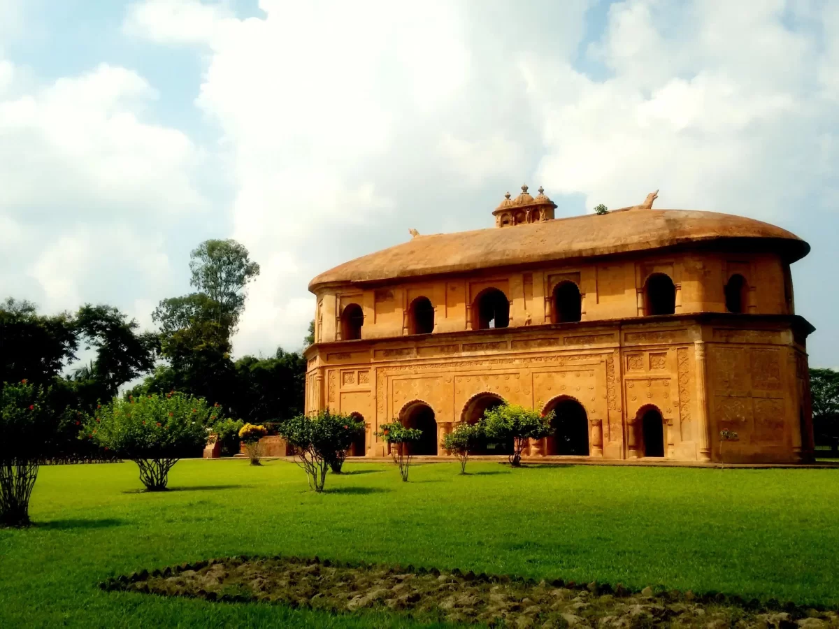
Visitors come to Bhalukpong Fort to explore the archaeological remnants of a 10th-century fortification that once guarded the strategic mountain pass between the Brahmaputra valley and the Himalayan interior. It serves as a significant site for those interested in the regional power dynamics of ancient Kamarupa, offering a tangible link to the legend of King Bhaluka and the historical fortifications that protected the foothills of Arunachal Pradesh.
The on-ground atmosphere is one of reclaimed wilderness, where stone ruins and ancient brickwork are integrated into the encroaching subtropical greenery. Situated on a bluff overlooking the Kameng River, the site offers a quiet, contemplative environment far removed from the transit noise of Bhalukpong town, allowing travelers to walk through the weathered foundations while listening to the distant roar of the river below.
What makes Bhalukpong Fort distinct is its position as the southernmost archaeological landmark of the state, representing a rare intersection of plains-style masonry and rugged hill terrain. Unlike the more famous monasteries of the north, these ruins provide a unique glimpse into the secular and military history of the region, offering travelers an evocative vantage point that connects the geological transition of the Assam plains to the soaring peaks of the Eastern Himalayas.
Bhalukpong Fort represents one of the few remaining archaeological links to the medieval history of the Arunachal foothills, situated strategically near the banks of the Kameng River. Traditionally attributed to the 10th-century King Bhaluka, the grandson of King Bana, the site marks a historical transition zone between the political spheres of the Assam plains and the tribal territories of the Himalayas. The remnants of the fortification, characterized by weathered brickwork and earthen mounds, indicate a past of sophisticated defensive planning aimed at controlling the vital trade routes that passed through this riverine gorge.
The site holds profound cultural significance for the local Aka (Hrusso) community, who view the ruins as a testament to their ancestral lineage and historical sovereignty over the region. While natural erosion and the passage of time have reclaimed much of the original structure, the area remains a focal point for understanding the socio-political dynamics of pre-colonial Arunachal Pradesh. For travelers, the fort serves as a silent witness to the intersection of mythology and history, offering an experience defined by its atmospheric location overlooking the Kameng valley and its role as the namesake of the modern town.
The ruins of Bhalukpong Fort, perched on the banks of the Kameng River, are best explored when the surrounding dense vegetation is manageable and the trails are dry. Because the site consists of ancient stone remains that can be obscured by rapid tropical growth, timing your visit is essential to ensure visibility of the structures and to avoid the leech-heavy undergrowth common during the humid months.
The ruins of Bhalukpong Fort, associated with the legendary King Bhaluka, are located on the banks of the Kameng River in the West Kameng district of Arunachal Pradesh. Accessing this historical site requires navigating to the border town of Bhalukpong via Assam.
 National Park
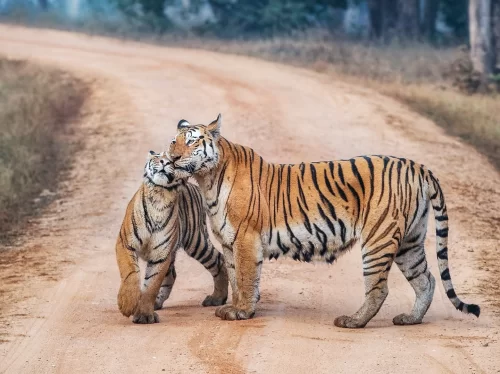
Pakke Tiger Reserve is a protected tiger reserve located in East Kameng district, Arunachal Pradesh, India.
 Waterfall
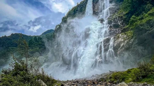
Navika Waterfall is a natural waterfall located near Bhalukpong in West Kameng district, Arunachal Pradesh, India.
 Viewpoint
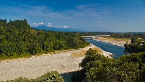
Sessa View Point is a scenic viewpoint located near Sessa village in the Bhalukpong region of West Kameng district, Arunachal Pradesh, India.
Get customized Arunachal Pradesh tour planning designed around mountain road distances, permit requirements, seasonal weather windows, and realistic travel pacing. Whether you are visiting for monasteries, high-altitude passes, river valleys, tribal cultu
⚡ Quick Response | 💰 Free consultation | 🕒 24×7 expert support

